Relic point Vietnam
Việt Nam
Tay Son Tam Kiet Temple
The Tam Kiet Tay Son Temple relic area includes 2 relics: Tay Son Palace and Truong Trau wharf site, located in Phu Phong town, Tay Son district, Binh Dinh province. associated with the names of three brothers Nguyen Nhac, Nguyen Hue and Nguyen Lu, leaders of the Tay Son movement, Tay Son dynasty at the end of the 18th century; decided to be classified as a special national monument by the Prime Minister on December 31, 2014). Historical sources say that the ancestors of the Tay Son Dynasty were originally from the Ho family in Hung Nguyen district, Nghe An. Come to rest in Tay Son Nhat hamlet, Quy Ninh. Nguyen Nhac's father, Mr. Ho Phi Phuc, and his wife, Ms. Nguyen Thi Dong, moved to Kien My village (now block 1, Phu Phong, Tay Son, Binh Dinh) to live for business purposes. Kien My village is also a gathering place for martyrs and the first base of the peasant movement in the lower Tay Son region. Nguyen Nhac and his two younger brothers, Nguyen Hue and Nguyen Lu, led the Tay Son uprising to bring Nguyen Hue and Nguyen Nhac to the throne. After the fall of the Tay Son dynasty, the house of Mr. and Mrs. Ho Phi Phuc's family in Kien My village was burned and razed. Some time later, right on the old house's foundation, local people contributed their contributions to build a tall and majestic communal house to secretly worship Tay Son Tam Kiet, named Kien My village communal house. In 1946, the communal house burned down. In 1958 - 1960, Binh Khe people once again built a new temple named Tay Son Palace, officially worshiping the three Tay Son brothers and holding an anniversary festival. commemorate every year. Tay Son Dien is built in the style of Dinh, with split stone foundations, solid brick walls, and cement tiled roof, with an area of over 100 square meters. The main shrine has three compartments, in the middle worships Emperor Quang Trung - Nguyen Hue, on the right worships Emperor Thai Duc - Nguyen Nhac, on the left worships Dong Dinh Vuong - Nguyen Lu, on the left and right the shrine worships military mandarins and ancestors. In the Tay Son family, the two gables have gongs and drums to serve ceremonies. In 1998, the State built and expanded Tay Son Palace. The temple was rebuilt with ancient architecture, quite large and majestic, three times the area of the old temple, made of reinforced concrete, Recreating the large, well-structured columns like an old communal house, the roof is cast in concrete, and covered with funny-nosed scale tiles. In front of the main temple, there is a pavilion like the old temple, on both sides there are two rows of large columns decorated with majestic dragons wrapped around the columns. In front of the house is a red granite stele with a summary of the temple's history. The Electric Gate remains the same. The well site was embellished with a hexagonal shelter, a concrete roof covered with scale tiles, and the surrounding Tamarind tree was also renovated more spaciously than before. In 2004, nine ceramic statues were brought back, covered in real gold on the outside, and placed in the inner sanctum. The rear hall has 3 altars, in the middle is the altar worshiping Emperor Quang Trung - Nguyen Hue; On the right is the altar worshiping Emperor Thai Duc - Nguyen Nhac; On the left is the altar of Dong Dinh Vuong - Nguyen Lu. Behind the altars is a large wooden diaphragm with carved dragons, patterns and gilded lacquer. In front, on both sides of the three altars, there are two wooden shelves holding eight sets of weapons. On the East and West sides of the inner palace, there are altars to worship civil servants, gods, and military generals of the Tay Son period. Although Tay Son Palace has gone through ups and downs over the years, it has been preserved, preserved and promoted by local people for generations to commemorate and pay tribute to the great contributions of national hero Quang Trung. – Nguyen Hue in his career of fighting to build and defend the country. Source: Department of Culture and Sports of Binh Dinh Province
Gia Lai
10448 view
Rating : Special national monument

Historical site of collective grave of martyrs of the Golden Star Division
The relic is a mass grave in Tay Phuong Danh area, Dap Da ward, An Nhon town, the resting place of 153 soldiers of Battalion 6, Regiment 12, Golden Star Division who died in the General campaign. offensive and uprising in the Spring of Mau Than 1968. Opening the 1968 Spring Mau Than campaign, in An Nhon area, from December 25, 1967 to January 17, 1968, provincial and district soldiers and guerrilla forces coordinated to attack the enemy in many places, causing them harm. much damage. Battalion 6, Regiment 12, Sao Vang Division of Military Region 5 was assigned the task of fighting the enemy in areas close to the provincial capital, attracting the enemy to the countryside so that the liberation army could attack Quy Nhon town. After attacking the Phu Cat training center on January 19, 1968, the Battalion destroyed the enemy holding the Sita - Nhon Hung bridge on Highway 1. Fearing the loss of Dap Da, the district capital of An Nhon and Quy Nhon will be threatened, the enemy has sent here a regiment of South Korean soldiers, 4 security companies, 32 tanks and armored vehicles to surround Battalion 6 and use artillery to counterattack. With superior military and weapons superiority, the enemy drove the people out, trying to surround and isolate the soldiers of Battalion 6 in the Tay Phuong Danh area to destroy them. The unit fought bravely with the enemy for 5 days and nights, from January 20, 1968 to January 24, 1968 until there were no more bullets left, the soldiers used hoes, shovels, and bayonets to attack with armor. fought with the enemy and sacrificed heroically. Admiring the tenacious fighting spirit, courage and indomitable sacrifice of the soldiers of Battalion 6, the People, despite the danger, buried 153 soldiers' bodies in a mass grave in the Tay Phuong Danh area - Smashing Rocks in infinite grief. People around the area call it Ma To. The mass grave of soldiers of Battalion 6, Regiment 12, Golden Star Division was ranked as a provincial revolutionary relic by the Provincial People's Committee on October 20, 2003. In 2016, the collective grave of soldiers of Battalion 6, Regiment 12, Golden Star Division was invested in many renovation items: building an incense house, carving stone tombstones, covering the entire grave with granite, and making a yard. The garden creates a clean and beautiful landscape, expressing the people's affection for the relatives of the Northern martyrs who fought and sacrificed for the South. Binh Dinh Provincial Museum is preparing a document to request the Ministry of Culture, Sports and Tourism to upgrade it to the national level to match the historical value of this relic. Source: Binh Dinh Province Electronic Information Portal
Gia Lai
9729 view
Rating : Provincial level relics

Ancient Go Sanh ceramic kiln
Go Sanh or Sanh hamlet is the name of a small hamlet in Phu Quang village, Nhon Hoa ward, An Nhon town. Phu Quang people say that while digging land for construction or farming, they often come across areas thick with intact pieces of ceramics of many types such as bowls, plates, and cups. Around the 70s, Go Sanh ceramics followed antique dealers to many regions and attracted the attention of ancient ceramic researchers in Vietnam and the world. In March 1974, an archaeological team from Saigon came to Phu Quang to research. Although there have been no excavations at Go Sanh, they have hypothesized that the owners of Go Sanh pottery are Cham people. From the above information, the Hanoi Institute of Archeology and Binh Dinh General Museum have planned a long-term research program at Go Sanh and all ancient ceramic relics in Binh Dinh. Until 2000, there were 4 excavations continuously conducted at this relic site. Up to now, Binh Dinh pottery kilns have 5 groups. In An Nhon town, there are Go Sanh, Go Cay Ke, and Go Hoi. All of these relics are located along the banks of the Kon River flowing into Thi Nai Bay (Quy Nhon port today) - a convenient location for waterway transportation. Archaeological excavations at Go Sanh were carried out in 1991, 1992, 1993. In 1994, besides Vietnamese scientists, there was additional cooperation from Japanese scholars. Among the kiln sites that have been identified in 5 locations within the former Vijaya region, kilns No. 1, No. 2 and 3 are in Go Sanh. Furnace number 1: Named Cay Quang furnace. The kiln is still quite intact, from the kiln wall, kiln floor and the final fired product of this kiln. The furnace has a tubular shape with a total length of 14m. The furnace chamber is rectangular, gradually expanding towards the end, measuring 1.6m; The width at the front is 2.8m; at the rear and an additional 10m in length. On one side of the oven wall there is a door for loading and unloading products. Furnace number 2: It is called Cay Man furnace (Roi Tree). The kiln area is located in the south of Go Sanh. Technically similar to furnace No. 1 (Cay Quang furnace), the furnace wall is also built of compacted soil bags and the arrangement of fire sharing columns in the burner is similar. Furnace No. 3: Located under furnace No. 2. According to researchers, this is the furnace with the earliest construction date. The wall of furnace No. 3 is not made of burnt shell material but is completely made of earth. The furnace is 1.2m wide near the burner, 1.7m wide at the back. The length of the furnace body is 5.3m. Currently, the Binh Dinh Provincial General Museum collects and preserves a quite rich collection of Go Sanh ceramic products. Porcelain products mainly produced here include enameled bowls, plates, pots, unglazed tiles and architectural decorations. Celadon enameled dishes and brown enameled jars show similar characteristics to the products of Fujian kilns (China). Recent information shows that Go Sanh Binh Dinh ceramics are produced not only for local service but also to participate in the export market to countries in Southeast Asia and further afield, Egypt. Among the artifacts found on the shipwreck in the Calatagan archipelago off Pantanan Island in the Philippines are thousands of Go Sanh ceramics. Some Vietnamese experts believe that the beginning of Binh Dinh ceramic production may have started from the late 13th to the 14th century, or at the latest until the 16th century. The owners of Go Sanh pottery kilns and other ancient pottery kilns in Binh Dinh are none other than the ancient Champa people. Go Sanh pottery kiln archaeological relic site has been ranked by the State as a National Historical-Cultural Relic. Source: Website of An Nhon Town People's Committee
Gia Lai
5919 view
Rating : National monument

Thap Thap Pagoda
Di Da Thap Thap Pagoda is located in Van Thuan village, Nhon Thanh ward, An Nhon town, Binh Dinh province. The name of the pagoda "Thap Thaps" is because previously there were 10 Cham towers on this hill, which later collapsed. The name "Amitabha" is the title of the Buddhist leader of the Pure Land. Amitabha also means reason, the original awareness of sentient beings. Combining the above meanings, the ancestral temple is named Thap Thap Amitabha Temple. Thap Thap Di Da Ancestral Pagoda is associated with the name of the founder, Zen Master Nguyen Thieu. Many documents today indicate that his surname was Ta, self-named Hoan Bich, from Trinh Huong district, Chaozhou district, Guangdong province, China. He was born in the year of the Rat (1648), and at the age of 19 became a monk at Bao Tu Pagoda. In 1677, he followed a Chinese trading boat to Quy Ninh district, now in Binh Dinh province, about 28 km from Quy Nhon city, and built a hermitage to worship Amitabha Buddha. In 1683, the pagoda used bricks and stones from 10 fallen towers to build the pagoda. The pagoda has gone through 16 generations of lineage with many famous Zen masters such as: Zen Master Lieu Triet, Zen Master Minh Ly, Zen Master Phuoc Hue... Zen Master Phuoc Hue has been honored as National Master. He was invited to preach sutras in the Nguyen royal palace from the reign of King Thanh Thai to King Bao Dai, and taught Buddhism at Truc Lam and Tay Thien Buddhist schools (Hue) since 1935. From outside, walking along the lotus pond to the temple gate, there are two tall square pillars, on top of which are placed two lion statues sitting majestically, connecting an arc, above are attached two words "Thap Thap". Behind the gate is a screen with an embossed dragon and horse symbol placed on a kneeling pedestal. The main hall was rebuilt by Zen Master Lieu Triet in 1749. Today's main hall has a straight roof, yin-yang tiles, and two dragons with pearl paintings on the roof. The Buddha hall is decorated solemnly, in the middle worshiping statues of Tam The Buddha, Chuan De, Ca Diep, and Ananda; The shrine worships Avalokiteśvara Bodhisattva and Ksitigarbha Bodhisattva, placed in two compartments on either side of the Buddha hall; On the left and right walls, there are statues of Thap Bat La Lan, statues of Thap Dien Minh Vuong, Dharma Protector, Patriarch Dat Ma and Patriarch Ty Ni Da Luu Chi. Most of the worship statues were carved during the reign of Zen Master Minh Ly (1871-1889). The pagoda was given a sign by Lord Nguyen Phuc Chu "Sac Tu Thap Amitabha Pagoda" hanging in the middle of the main door of the main hall, which was engraved by Venerable Mat Hoang in 1821. The big bell (cast in 1893) and the big drum were placed. at both ends of the hallway. Behind the main hall, there is a stele inscribed with the poem "Thap Thap Amitabha Pagoda" written by layman Duong Thanh Tu and founded by Venerable Minh Ly in 1876. The monk's house is located behind the main hall built by National Master Phuoc Hue in 1924. The Patriarch's house is in the south, connecting the main hall and the monk's house, worshiping the Patriarch of Khai Son Nguyen Thieu and the late abbots and monks. and past Buddhists. Opposite the Patriarch's house is the lecture hall, there is a wooden board with the article "Thap Thap Tu Chi" written by An Nhon Academician Vo Khac Trien in 1928, recording the history of enlightenment, the process of construction and inheritance. of Thap Thap ancestral temple. In particular, Binh Dinh Newspaper said that the pagoda still retains 2,000 wood carvings used to print the Amitabha Sutra, Diamond Sutra, Lotus Sutra, etc. The Tripitaka offered by Governor Ha Tien Mac Thien Tu also exists. 1,200 volumes of sutras, laws, treatises and records. The pagoda also preserves the Korean Tripitaka and the Taiwanese Tripitaka. The Patriarch Tower Garden is located in the North with 20 ancient towers containing the bodies of the abbots and monks in the temple. Behind the pagoda, there is also the White Tiger tower and the Council tower The pagoda has been recognized by the Ministry of Culture as a national historical and cultural relic. Amitabha Thap Thap Pagoda is the most famous pagoda in the Central region. Source: Website of An Nhon Town People's Committee
Gia Lai
5694 view
Rating : National monument

Canh Tien Tower
Canh Tien Tower is located on top of a not very high hill in the center of Do Ban citadel, the ancient capital of the Champa kingdom in Nam An village, An Nhon town. In the book Dai Nam Nhat Thong Chi, it is written: "An Nam ancient tower in Nam An village, Tuong Van district, in Do Ban citadel, is commonly called Canh Tien tower. From the shoulder of the tower up, all four sides look like fairy wings, so it's called that name." French researchers, in their own way, call it Tour de Cuvre (Bronze Tower). Towers are a popular architectural form of Champa culture. In Cham language, there is a common word for this type of architecture: Kalan (temple). The main function of Kalan, as the word implies, is to serve spiritual life and religious rituals. However, the tower's architecture is deeply artistic and is a work in which artisans express their talent and creativity, so it is less constrained by religious rituals. Among them, Canh Tien is a beautiful tower, uniquely shaped and elegant with a very reasonable layout. The tower was built tall and imposing on a nearly square plane, each side about 10 meters long with staggered ramps. The entire tower is about 20m high, all four sides around the tower's body are decorated with wall pillars, protruding in a harmonious ratio with the overall architecture. The corners of the tower body are made of large stone blocks so it is quite sturdy. In terms of form, the tower has 4 soaring pointed arch doors opening in 4 directions, but only the main door facing east is connected to the heart of the tower, the rest are 3 fake doors. The slightly protruding frill forms a support for the corner towers above. The carved images are mainly concentrated on the roof. With four existing floors, each floor has 4 decorative corner towers, each corner has small floors, creating a leaf shape that gradually gets smaller towards the top, creating the feeling of birds in flight. Perhaps it is because of this appearance that people let their imagination run wild, associated with the image of a fairy and named the tower Canh Tien. The carved stones in the shape of a phoenix tail mounted on the floors of the fake tower and the image of Makara, a sea monster in Indian mythology with sharp fangs and a long trunk, decorating the corners of the walls give Canh Tien tower a beautiful look. Luxurious, mysterious. Unlike many Cham towers, the decoration of Canh Tien tower is elaborate to the point of perfection. From the door arch system to the flexible, symmetrically layered spiral pattern strips to the delicately carved stone blocks forming connected patterns, all exude a beauty that is both elegant, elegant, and majestic. suspicious, superficial. It is also possible that due to its graceful beauty, the tower also has the folk name of Daughter tower. According to ancient documents, Do Ban citadel was built by Champa king Ngo Nhat Hoan in the 10th century, while Canh Tien tower was built in the 12th century, under the reign of King Che Man (Jaya Sinbavarman III). Perhaps this is the Che Man tower dedicated to Queen Paramecvari, Princess Huyen Tran, the noble Vietnamese girl who put her interests first and formed a historic relationship with him. Legend has it that before leaving Dai Viet, the Tran Dynasty's princess with jade leaves and golden branches learned thoroughly all royal rituals and Champa folk activities. Working as a bride far from home, she was loved and respected by her subjects because this Vietnamese queen not only spoke Champa language fluently, knew how to sing and dance Champa folk songs, but also took the trouble to teach the royal palaces. Women and subjects from their husband's hometown weave cloth, grow rice, embroider, and sew. It is not an exaggeration to say that: Marrying Huyen Tran, Che Man's bride price was the two continents O - Ly, and Canh Tien Tower was the love gift he gave her, as a sacred recognition of his people. . Source: Website of An Nhon Town People's Committee
Gia Lai
8405 view
Rating : National monument

Citadel Emperor
Emperor Citadel is located in Nhon Hau commune and Dap Da ward, An Nhon town, 27km northwest of Quy Nhon. Emperor Citadel was built by the Tay Son dynasty in 1776 on the basis of Do Ban citadel left by the Champa Kingdom and was officially named Emperor Citadel since 1778. During a long period from 1776 to 1793, The citadel was the headquarters of the Tay Son army and later the capital of the central government of Emperor Thai Duc - Nguyen Nhac. The Imperial Citadel was originally a rectangular architectural complex, consisting of three citadels: the Outer Citadel, the Inner Citadel and the Forbidden Citadel. The outer citadel has a circumference of 7400m. The Citadel, also known as the Imperial Citadel, has a rectangular shape of 430m long and 370m wide. Inside the Citadel is the Forbidden City, also rectangular, 174m long and 126m wide. Through many excavations, many architectural works have been revealed, proving that the Thai Duc dynasty developed on this land. That is the main hall's floor, the octagonal floor with Bat Trang tiles and Champa white stone. The two semi-circular lakes are symmetrical around the octagonal palace, with rows of coral stones and stone steps attached to the lake. In addition to two semicircular lakes, the excavation also revealed a heart-shaped lake. Hundreds of years old fig trees next to Gia Son island. The square well at the corner of the citadel is paved with laterite, but the water is still clear to this day even though over time the plants and trees accidentally cover it. The Imperial Citadel also witnessed battles between the Tay Son and Nguyen dynasties, including the siege battle between the two Tay Son generals, Tran Quang Dieu, Vo Van Dung, and general Vo Tanh in May 1801. Unable to resist the Tay Son army, Vo Tanh self-immolated along with the civil servant Ngo Tung Chau, who drank poison and committed suicide. After the fall of the Tay Son Dynasty, this place became a place to worship the "twin faithful" Vo Tanh and Ngo Tung Chau. Although the Imperial Citadel is only a historical relic, the culture and craft villages around the citadel are still the same as ever. Not as many as the "36 streets" of Thang Long citadel, but around the Emperor Citadel there are still many craft villages bustling with production such as Van Son pottery village, Phuong Danh weaving village, Bang Chau bronze casting village, wood turning village, etc. hats... show a bustling capital with horses, carriages and prosperity, making us feel uneasy thinking about an ancient legend. The citadel was recognized by the Ministry of Culture and Information as a national monument in 1982. Source: Website of the People's Committee of An Nhon town
Gia Lai
5516 view
Rating : National monument
Ta Vai Bridge
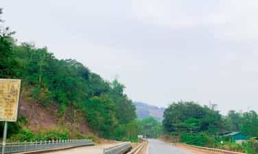
Ta Vai Bridge, located in Ta Vai village, Chieng Hac commune, Yen Chau district, is a famous historical relic of the province. During the resistance war against the French colonialists, the bridge not only had a meaning for people's livelihood but was also a historical relic. Ta Vai village has a bridge with 46 fierce attacks and suffered 1,272 bombs from American aircraft to cut off the main artery of Highway 6. But the bridge still stands, ensuring smooth traffic. In 1965, the American enemy used air force and commandos to frantically sabotage the North in order to prevent the North from providing support to the Southern people. On June 20, 1965, American planes dropped 6 bombs on Khau Day village (Chieng Hac, Yen Chau) and 20 rockets on Ta Vai bridge. . Starting from here, American aircraft continuously bombarded Yen Chau, but due to good preparation of plans to deal with America's destructive war, Yen Chau entered the war without being surprised. At this time, Ta Vai bridge became a place of fierce fighting between us and the enemy. With the determination to ensure smooth traffic flow in all situations, determined to stay at the traffic center of Ta Vai bridge, the militia and self-defense force and armed force units have always stuck to the road and bridge to ensure traffic is clear. Here, from March to December 1966, we arranged the 14th Battalion of anti-aircraft artillery to protect the Ta Vai bridge, in which Company 3, consisting of two 37mm artillery batteries, was positioned in the area of Ban Tat hill. , adjacent to Tai Vai bridge, Company 2, consisting of four 37mm guns, was arranged in a continuous position to the west of Ta Vai bridge. In addition to the two main battlefields with 37 mm cannons, there is also a secondary battlefield consisting of a 12.7 mm company located in lower terrain also near Ta Vai bridge. To arrange such a battlefield, the people of Ta Vai village and the soldiers dug fortifications to build a road around the hillside to pull up artillery. Each 37 mm cannon required 200 people to pull it. To encourage morale and help soldiers fight, the people of Ta Vai village enthusiastically participated in the fighting and produced rice to contribute to the front lines. During those years, the people of Ta Vai, along with other villages in Chieng Hac commune, contributed nearly 9 tons of vegetables, 500kg of poultry, tons of food... In addition, the commune's performance team also went to the battlefield in uniform. army and militia service. Many times having to move the battlefield, the people and the soldiers used forest rope to braid to pull the artillery; used bamboo to make shacks for the soldiers and helped the soldiers dig over 3,000 meters of shelters on the battlefield with the determination to protect the transportation artery for the battlefield. The enemy destroyed bridges and roads, but the spirit of the army and people here was undeterred. Despite the roar of bombs and bullets, they still enthusiastically repaired the roads for vehicles to pass, with the emulation movement "Singing over the sound of bombs" and "Singing over the sound of bombs" and "Singing over the sound of bombs" The enemy broke it, I'll fix it. If the enemy destroys me, let me go." On December 8, 1966, the enemy organized 3 groups of planes to drop bombs on the hill where there was an anti-aircraft artillery battlefield and bombarded the Ta Vai bridge. At this time, 2 bridge spans were hit by bombs and fell into the stream and traffic on Route 6. was cut. Because the bridge was in a dangerous location, the stream was wide, the water was deep, and the enemy fought day and night, so it was very difficult to rebuild the bridge. Faced with that situation, the bridge protection unit decided to build a bypass and underground road to ensure traffic at all costs. The underground tunnel of Ta Vai bridge was built by soldiers and civilians about 1km downstream, but the enemy still discovered it and continued to bombard it. With courageous fighting spirit, the army and militia units have well secured traffic arteries. Promoting the tradition of tenacious fighting and the spirit of solidarity, the people of Ta Vai village with a boiling spirit of hatred for the invaders turned into revolutionary actions in combat and production, making an outstanding contribution to the achievements in defeating the US imperialist plot to expand the war. At the Ta Vai battlefield, the army and people of Yen Chau shot down 2 F105 planes and captured American enemy pilots with rifles, the lifeline of support for the South was always running smoothly, that victory quickly spread throughout the world. place, known throughout the country. Today, the war has receded into the past, the people of Ta Vai work hard in production and continue to contribute human and material resources to their homeland, where the Ta Vai bridge marks the crimes of American imperialism during the war. war of invasion in Vietnam. Talking about Ta Vai bridge is talking about the heroic, resilient fighting spirit and glorious fighting of Yen Chau's army and people. Source: Son La province electronic information portal
Son La
9420 view
Rating : Provincial level relics

A Phu Cave
Tham Can Cave, also known as the "A Phu Couple" cave, was the 99th revolutionary base during the resistance war against the French in Son La province. The cave belongs to Hong Ngai commune, Bac Yen district, Son La province. The relic includes two caves: The first cave (dry cave) is located at the foot of U Bo mountain, surrounded by primeval forest, with a cool, airy climate. In front of the cave is the people's fields, covered in all four seasons with green flowers and fruits. The dry cave consists of 2 doors located on the East and West sides, connected to each other, dividing the cave into 3 compartments. The total length of the cave from West to East is about 200m. The western door is about 3m high, 1.5m wide, the entrance to the cave is small and narrow, limiting light. The deeper you go, the more the cave expands, with an average ceiling height of 20 to 40 meters and an average width of 15 to 30 meters. The cave floor is rough and slightly sloping, with many rocks scattered all over the cave floor. The ceiling of the cave has many beautiful stalactites shaped like animals, forests, etc. In the second and third chambers, there are also many narrow niches running along the cave walls, on average 10 to 15 meters deep. Go through compartment 3 to reach the east door. The oval cave entrance is about 50 to 60 meters high, about 20 meters wide at the bottom, and about 30 meters wide in the middle. This is where the Military Intelligence Company of the General Staff temporarily stayed for two days to find a way to cross the Da River to prepare for the 1952 Northwest campaign. According to local people, Tham Biet cave was also the place where soldiers and soldiers were stationed. storing weapons of our army and people in the resistance war against American invasion. In addition, Tham Bien cave is also known in literature as A Phu Couple Cave. According to legend, after escaping from Governor Pa Tra's family to reach the Phieng Sa guerrilla area, My and A Phu (the two main characters in the work) stopped here for a while to avoid being searched by the bandits. Governor. The second cave is a water cave about 20 meters south of the first cave. The entrance to the cave is about 5 meters deep underground. The road down to the cave is steep, has many bumpy rocks, and is very dangerous. The cave is about 300 meters long. The cave is dark, about 7 meters wide, from the cave floor to the ceiling is on average about 10 to 12 meters high, in some places it is only 4 to 5 meters high. The cave floor is a stream flowing along the cave from West to East. This is where the Military Intelligence Company came to get water for daily use during their temporary stay in the dry cave. Tham Can Cave - Resistance Base Area 99 was ranked as a Provincial Historical Monument on May 28, 2012. Source: Electronic information portal of Bac Yen district, Son La province
Son La
7032 view
Rating : Provincial level relics
Historical relic of Na San stronghold group
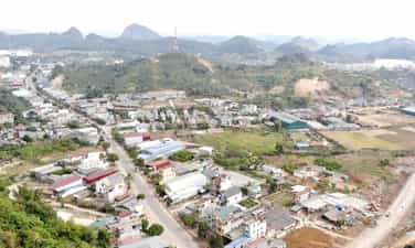
The Na San stronghold group is located on the Na San plateau, a basin in Chieng Mun commune - Mai Son district - Son La province with an area of about 10km2 surrounded by mountains over 700m high. There is an airport, a command post, a number of posts, a strong firepower system of four 105mm guns and many trenches surrounding the central area. Like the Dien Bien Phu base group, the most important part of this military base is Na San airport, which is responsible for supplying French troops on duty here. This airport was built in 1950 when the French army dominated and oppressed the people of the Northwest ethnic groups after taking control from the Viet Minh. Initially, Na San airport served the needs of travel with a short, small runway system and simple structure. It was later expanded, lengthened and upgraded with iron grate flooring, able to meet all types of traffic. Dakota planes take off and land. For nearly a month since the French army withdrew here, they have continuously reinforced food, weapons, ammunition, barbed wire and other necessary materials to reinforce this military base. . Because time was tight, the fortification system here was quickly made with rudimentary materials such as bamboo, wood, etc. and was temporarily built and covered for living and fighting. At the bases in the central area and around the airport, priority is given to being solidly built with cement, sand, and paved with iron sheets. The central command tunnel also has a relatively safe trench system to escape to the airport in case of need. The Northwest Campaign began on October 1, 1952 and ended on December 10, 1952. After 3 fierce attacks by our army and people, the campaign quickly ended 4 months earlier than the original estimate. We destroyed many enemy troops and captured many weapons and ammunition. The enemy had to withdraw to cluster at the Na San stronghold group. Faced with a completely passive and isolated situation, they knew they could not survive on this land, so they secretly fled by air from Na San airport. The Northwest Campaign ended in complete victory. Up to now, little is known about the Na San stronghold group because of its small scale and passive nature of response. However, this was the first origin for the form of attacking a group of strongholds of the French colonialists, the idea of forming the Dien Bien Phu stronghold group later, and the first form of defense with strategic significance that appeared. present during the Vietnam War. The Na San stronghold group is evidence of the heroic years of our army and people fighting against the French colonialists in the Northwest battlefield, a mark of the disastrous defeat of the French colonialists. Na San stronghold group was ranked as a national historical relic on January 24, 1998. Source: Son La province electronic information portal
Son La
8103 view
Rating : National monument
Thuan Chau Flag Tower historical site
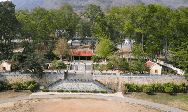
Thuan Chau Flag Tower historical site is located in Pan village, Chieng Ly commune, Thuan Chau district. This place marks a historic event on May 7, 1959, when President Ho Chi Minh together with the Party and Government leadership visited the Northwest. During the resistance war against the French and after peace was restored in the North, despite being busy with thousands of national affairs, Uncle Ho, the beloved Father of the nation, always cared about the people of the Northwest ethnic groups. Responding to Uncle Ho's trust, the people of the Northwest ethnic groups were courageous in fighting, enthusiastically emulating productive labor and wished to welcome Uncle Ho to visit and report to him on his achievements. On May 7, 1959, the wishes of the people of the Northwest peoples came true. The square of the capital of the Thai autonomous region, Meo, was resplendent with flags, flowers, banners and slogans and more than 10,000 people representing 430,000 people from the Northwest ethnic groups happily welcomed Uncle Ho leading the Party and Government delegation. cover the visit. With an extremely simple, intimate and close gesture, Uncle Ho recognized and praised the sacrifices and enormous contributions of the people of the Northwest ethnic groups in the resistance war against the French colonialists and in restoring the economy. economy after the war. On behalf of the Government, he presented the people of the Northwest ethnic groups with the first-class Labor Medal. He advised: We must enthusiastically compete for economic and social development, strengthen economic sectors, apply science and technology to production, develop education and healthcare networks, and strengthen national security. room. More than 40 years have passed, and his advice has been persistently strived to be implemented by the Party Committee, government and people of Son La ethnic groups, and has been making great changes in the Western region of the country. big. Today, the Thuan Chau flag tower historical relic is located right on the campus of Thuan Chau district stadium. Source: Son La province electronic information portal
Son La
9226 view
Rating : National monument