Relic point Vietnam
Việt Nam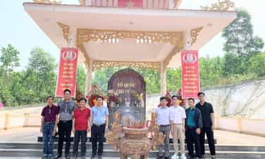
Revolutionary base area of Hoa Vang District Party Committee
Hoa Vang District Party Committee's revolutionary base is located in the triangle area of Phu Tuc - O Ray - Tong Coi mountains, in Hoa Vang ward. With rugged mountainous terrain, this place was once an important base for revolutionary forces in the two resistance wars against the French colonialists and the American imperialists. From the years 1947–1949, the Dong Xanh - Dong Nghe area was chosen as the location for the leadership of the Hoa Vang District Party Committee. By 1955, the Quang Da Provincial Party Committee built the Hoa Vang West wing revolutionary base (codename B1), turning this place into the center for directing the revolutionary movement of the western and northwestern regions. During this time, Da Nang Stone and Non Nuoc Stone became sacred symbols of patriotism and the will to fight resiliently. Since 1960, the triangle area of Phu Tuc - O Ray - Tong Coi continued to be chosen as the resistance base of the Hoa Vang District Party Committee. This is the workplace, direction and activity of many district leaders, and is also the venue for conferences, Party congresses, military and political training for revolutionary forces during the years of resistance against the US. The rugged mountainous terrain has contributed to shielding and protecting the headquarters against many enemy raids. During the two resistance wars, Hoa Vang District Party Committee Revolutionary Base played the role of an important leadership, command and rear base of the local revolutionary movement, associated with many historical events and activities of leading officials at the provincial, regional and district levels. To preserve those historical values, the relic site has been invested in building exhibition houses, memorial stele and other items for sightseeing. Today, this place has become a red address for educating patriotic traditions, commemorating previous generations of revolutionaries and a destination to help tourists learn about the history of the heroic struggle of Hoa Vang's army and people in the cause of national liberation. According to: Da Nang Newspaper
Da Nang
243 view
Rating : National monument
Hai Van Quan
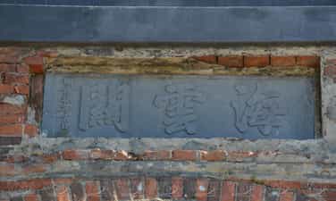
Hai Van Quan is a defensive military project built in 1826, during the reign of King Minh Mang. The relic is located on top of Hai Van Pass at an altitude of about 496 m above sea level, at the border between Hue city and Da Nang city. This is a strategic location on the North - South traffic route, and is also the gateway to protect the capital Hue from the south. Since the time of the Nguyen Lords, Hai Van Pass has been considered a dangerous land, playing an important military and defensive role. When the Nguyen Dynasty chose Hue as its capital, this place was considered the "throat" of the country. Therefore, King Minh Mang built Hai Van Quan to control the Thien Ly road and strengthen the protection of the capital. The project includes two large city gates built of brick and stone in a rolling arch architecture. The gate facing Da Nang is engraved with three words "Hai Van Pass", while the gate facing Hue is engraved with six words "The most majestic pass in the world" - a praise for the majestic beauty and critical position of Hai Van Pass. Surrounding the gate is a solid wall system with military items such as garrisons, weapons warehouses and observation positions. Through many historical upheavals, especially during the French colonial period and the war, Hai Van Quan was converted into a military base, many original architectural items were destroyed or degraded. By 2017, the monument was ranked as a National Monument, and from 2021, Hue and Da Nang have coordinated to implement a restoration project, restoring important items, contributing to restoring the original appearance of the building. Today, Hai Van Quan is not only a historical relic of special value but also a famous stop on the Hai Van pass road. From here, visitors can enjoy a panoramic view of the mountains, the sea and one of the most beautiful coastal roads in Vietnam. With unique historical, architectural and landscape values, Hai Van Quan is a destination not to be missed in the journey to explore the Central region. According to: Vietnam News Agency
Da Nang
675 view
Rating : National monument
Tomb of Mr. Banjiro - Japanese businessman
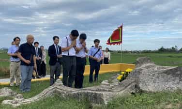
Tomb of Mr. Banjiro - Japanese businessman - Truong Le Block - Cam Ha Commune Mr. Banjiro was a Japanese businessman who died in Hoi An. The tomb is near the road from the old town down to An Bang beach and still retains the original traces of construction from the 17th century. The tombstone is dated 1665. Behind the tomb there is a cement stele engraved with Japanese characters, with the following content: "In the 3rd year of Showa (1928) at the suggestion of literature professor Kuroita Katsumi, a group of Japanese residing in Indochina (now Vietnam, Cambodia, Laos) asked Mr. Nakayama to supervise the repair of this tomb." Recently, Hoi An has continued to renovate and carefully preserve this tomb. The monument was ranked as a national monument in 1991. Mr. Banjiro's grave was built with a mixture of lime, sand, bark water, molasses... The grave is saddle-shaped, facing Northeast, measuring 190cm x 85cm. In front of the grave there is a stele made of rock salt, with two lines of words on both sides. Previously, this tomb had no one to look after or repair it. After the Ministry of Culture issued a decision to recognize Hoi An Ancient Town, this tomb site is regularly cared for by the Hoi An Monuments Management Board to preserve and repair. Currently, the tomb is regularly looked after by Mr. Nguyen Nuoc's family and burned incense. The relic contributes to clarifying the process of forming Hoi An Ancient Town, especially the period when Japanese traders came to Hoi An to trade. Source: Hoi An Ancient Town
Da Nang
219 view
Rating : National monument
Quang Da Special Zone Party Committee relic site
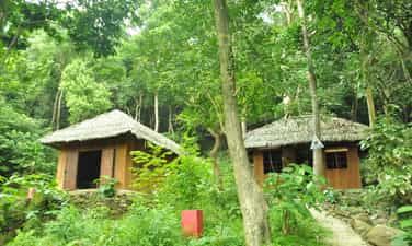
Quang Da Special Zone Party Committee relic site Hon Tau is a mountain range bordering Duy Xuyen, Nong Son and Que Son. With a strategic location, this place was chosen by the Quang Da Special Region Party Committee as a revolutionary base during the last 8 years of the war against the US (1967-1975). With the determination "Everything for the general attack, everything for the general uprising in the Spring of Mau Than 1968", the Quang Da Special Region Party Committee advocated centralized direction and mobilization of all forces to prepare for the uprising. Hon Tau base is where our officials and people suffered many sacrifices and losses. Many comrades were leaders of the Special Zone Party Committee and hundreds of officers and soldiers who heroically sacrificed their lives. In particular, 10 officers and employees of the Propaganda Department died when their living and working places were destroyed by American B52 bombs on the morning of May 22, 1972. Despite many sacrifices and losses, officers and soldiers of the Quang Da Special Region Party Committee still steadfastly continued to direct strategic attacks, decided on many important policies, and closely contracted with the main forces to liberate the western districts of Quang Nam province, creating a pincer position, contributing to completing the campaign to liberate Da Nang in 1975. In 2012, Hon Tau relic was ranked a national historical relic by the Ministry of Culture, Sports and Tourism. After the decision to classify the monument, the Department of Culture, Sports and Tourism of Quang Nam province prepared a dossier to submit to the Ministry of Culture, Sports and Tourism for approval and implemented a project to restore the monument. After more than 2 years of implementation, up to now, the Quang Da Special Zone Party Committee Relic Area has been basically completed on the occasion of the 50th anniversary of the establishment of the Special Zone Party Committee (October 1967 - October 2017). Source: Government Newspaper
Da Nang
307 view
Rating : National monument
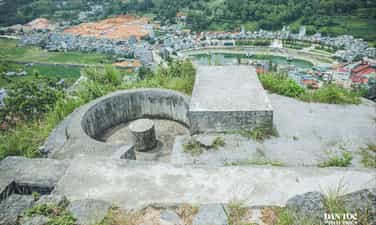
Don Cao historical site
Cao Dong Van Fort is located on a high mountain in the middle of a valley in Dong Van town, in the Dong Van Karst Plateau UNESCO Global Geopark area. Not only is it a historical relic, Don Cao is also an ideal viewing spot to admire the entire Dong Van town and the majestic scenery of the rocky plateau. Cao Fort, also known as Chang Poung Fort, was built by the French colonialists around 1925 on a mountain peak about 1,200 m above sea level. The structure is built mainly of stone with a system of solid walls, blockhouses, battlements and stone steps leading to the top. It was once an important military position during the French colonial period. Over time, many items have degraded and were partially restored in 2013 to preserve the value of the monument. From Don Cao, visitors can enjoy a panoramic view of Dong Van town with tile-roofed houses nestled among rocky mountains, fields of Nghien village, Tu San mountain, Si Phai pass and rolling cat-eared rocky mountains - a characteristic of the northernmost region of Vietnam. In the early morning or late afternoon, the scenery of mountain clouds blends together to create a natural picture that is both majestic and poetic. Today, Don Cao is a stop not to be missed on the journey to discover Dong Van. Besides its historical value, this place also gives visitors the opportunity to feel the beauty of the old town, nature and the peaceful life of highland people, contributing to enriching the experience when coming to Dong Van Karst Plateau. According to Tuyen Quang Newspaper
Tuyen Quang
717 view
Rating : Provincial level relics
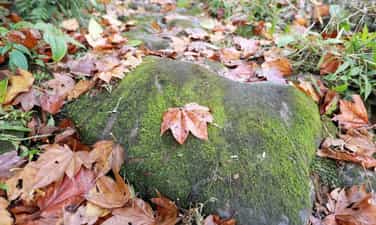
Pavie ancient stone road
Pavie Ancient Stone Road is an ancient road surveyed, designed and built by the French in the early 20th century, once a vital traffic route connecting Phong Tho district with Bat Xat district. The road is hidden among the Northwest mountains and forests, paved entirely with natural stone slabs, about 3 meters wide, convenient for pedestrians and pack horses. Up to now, about 17 km of stone roads are still preserved almost intact, becoming a valuable heritage, reflecting the construction techniques and trading history of the Northwest border region. Following the ancient road, visitors will admire primeval forests, majestic mountains, waterfalls and terraced fields typical of the highlands. Not only has historical value, the ancient stone road of Pavie is also a cultural intersection of the Dao, Mong and many ethnic groups living along the route. The journey to explore the road takes visitors to highland villages, which still preserve many traditional cultures, crafts, customs and unique cuisine. The route connects many attractive destinations such as Sin Suoi Ho - the famous community tourism village of Lai Chau and Den Sang, creating favorable conditions for developing various types of trekking tourism, exploring nature, experiencing indigenous culture and eco-tourism. With its pristine natural landscape, unique historical imprints and unique cultural identity of highland ethnic people, Pavie Ancient Stone Road is considered one of the potential tourist exploration routes of the Northwest region, contributing to preserving heritage and developing sustainable tourism associated with the local community. According to Lao Dong Newspaper
Lai Chau
677 view
Rating : Provincial level relics

Vietnam Military History Museum
Established on July 17, 1956 with the original name of Military Museum, located next to the Hanoi Flagpole, opened to visitors from December 22, 1959. Through the process of construction, development and continuous growth, the Museum was renamed Vietnam Military History Museum in 2002 and officially welcomed visitors at the location of Thang Long Avenue, Dai Mo Ward, Tay Mo, Nam Tu Liem District, Hanoi City (now Xuan Phuong Ward, Hanoi City) in November 2024. The museum has the function of researching, collecting, inventorying, preserving, displaying and propagating the value of Vietnam's military cultural heritage. The display system introduces thousands of artifacts, organized and arranged in a modern, scientific and rich manner, applying modern technology and advanced equipment, comprehensively reflecting the history of fighting against foreign invaders and gaining independence of the Vietnamese people; the formation and development of the people's armed forces, the core of which is the Vietnam People's Army during revolutionary periods. Through the exhibition system as well as educational activities, the Vietnam Military History Museum contributes to helping visitors understand more about the treasure of Vietnam's military cultural heritage, feel a strong connection with the past, understand more about the heroic history of the Vietnamese people, appreciate the existing values and look forward to a brighter and better future.
Hanoi
1416 view
Rating : National monument

Muong Tinh Cave (commonly known as Chua Ta Cave)
Muong Tinh Cave (commonly known as Chua Ta Cave) in Dien Bien is a magnificent natural masterpiece, outstanding with a diverse system of stalactites and stalagmites, sparkling with unique shapes such as terraced fields and raspberries, creating its own charm. The cave has a small and narrow entrance but a wide cave inside. There is a stream flowing inside the cave, creating a mysterious space and gurgling sounds, making it an attractive tourist discovery destination. The cave is ranked as a national historical relic according to Decision No. 1256/QD-BVHTTDL dated April 14, 2011. During the resistance war against the French colonialists, Muong Tinh cave was an important resistance base, a refuge for provincial agencies, soldiers,... especially during the first liberation of Dien Bien in 1953. Muong Tinh Cave consists of 3 main compartments. The outermost compartment has a narrow cave entrance, with an area of about 600 m², a height of 20 m, airy space, and a flat land. This is the ideal condition to organize meetings that can accommodate hundreds of people while still maintaining confidentiality. The middle compartment must crawl through a tunnel through natural rock. Inside is a space with an area of about 20 m², surrounded by stone walls, with small stone niches deep inside. This is where the revolutionary documents were hidden, with a system of desks and beds made entirely of stone arranged naturally but very reasonably. This is a secret place, but also very safe when an incident occurs. There is a small road through the top of the mountain, soldiers can get out of the forest without the enemy being able to detect it. Inside is the third compartment, about 30 m² wide. Chua Ta Cave is an ideal destination for those who are passionate about exploring nature and looking for a unique experience when coming to Dien Bien.
Dien Bien
1557 view
Rating : National monument

Thanh Ban Phu
Ban Phu citadel (also known as Chieng Le citadel) is located in Noong Het commune, Dien Bien province, 8 km south of Dien Bien Phu city center. Ban Phu Citadel is a national historical site built by hero Hoang Cong Chat (1758-1762) to fight the Phe invaders, to serve as a solid base, and the capital of the insurgent army in the fight to liberate Muong Thanh. In the inner city of Ban Phu, after General Hoang Cong Chat passed away (February 25, 1767 on the lunar calendar), to show gratitude to the hero who had defeated foreign invaders and brought a peaceful life to the people, the people of Muong Thanh built a temple to worship Lord Hoang Cong Chat and 06 district gods: Lo Ngai, Bac Cam Khanh, Hoang Cong Toan, Bun Phanh, Vu Ta, Nguyen Huu, collectively known as Hoang Temple. Cong Quat. This is a unique ancient military structure with a deep moat, high citadel, and Hoang Cong Chat temple. Ban Phu Citadel is a symbol of the spirit of solidarity and resilience of our army and people in protecting the homeland's borders, and is an important historical and cultural attraction.
Dien Bien
1943 view
Rating : National monument

Dien Bien Phu Victory Monument
Dien Bien Phu Victory Monument, located on D1 hill, Dien Bien Phu city, is the largest bronze monument in Vietnam, symbolizing the famous victory in 1954. The Dien Bien Phu Victory Monument is 16.6m high, including 3 soldiers holding a Thai baby and a flag of victory, demonstrating the spirit of solidarity and resilient will of the nation. The path up to the monument consists of 320 steps, divided into 3 landings corresponding to 3 attacks, on both sides are 56 blue stone milestones symbolizing 56 days and nights of fighting. The Dien Bien Phu Victory Monument was inaugurated in 2004 (commemorating the 50th anniversary of the victory), this is an important historical attraction, marking the "illustrious victory of five continents, shaking the earth"
Dien Bien
1736 view
Rating : National monument