
 vn
vn en
en ja
ja ko
ko zh
zh


Cu Lao Dung - "island district" at the end of Hau Giang river
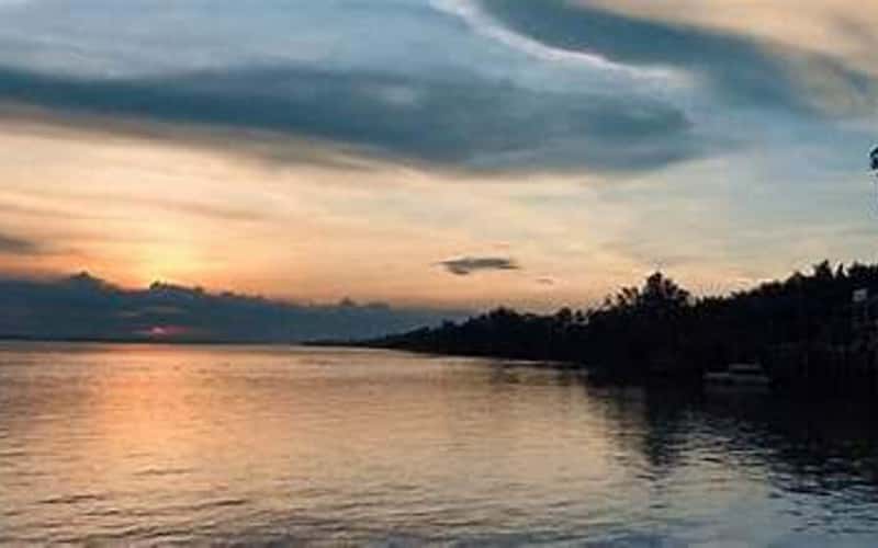
In the Mekong Delta, only Cu Lao Dung district (Soc Trang) is truly an "island district" when completely separate from the mainland. All trade routes connecting the island to the mainland until now (February 2023) are large ferries, small ferries, ferry boats... The late musician Hong Son (Soc Trang) wrote a song about Cu Lao Dung titled "Returning to An Thanh" with just more than ten sentences that describe all the scenery of this land: "Returning to my hometown when the river is full. The sugarcane banks are covered with flags, sparkling at the sunset. Cu Lao Dung forest in the changing winds, no one can go downstream in the wind. leisurely rowing rhythm...".
In the Mekong Delta, only Cu Lao Dung district (Soc Trang) is truly an "island district" when completely separate from the mainland. All trade routes connecting the island to the mainland until now (February 2023) are large ferries, small ferries, ferry boats... The late musician Hong Son (Soc Trang) wrote a song about Cu Lao Dung titled "Returning to An Thanh" with just more than ten sentences that describe all the scenery of this land: "Returning to my hometown when the river is full. The sugarcane banks are covered with flags, sparkling at the sunset. Cu Lao Dung forest in the changing winds, no one can go downstream in the wind. leisurely rowing rhythm...".
The Nguyen Dynasty's directory records: Before 1820, there were Vietnamese immigrants who came here to explore and establish 2 villages: An Thanh Nhut and An Thanh Nhi. Now this island has "bloomed and grown" into a district of Soc Trang province with 8 administrative units: An Thanh 1, An Thanh 2, An Thanh 3, Dai An 1, An Thanh Tay, An Thanh Dong, An Thanh Nam and Cu Lao Dung town with 23,606.29 hectares of natural area. The population is more than 58,000 people.
The mandarin road, the base of the fort and... "the tiger lady's creek"
The canals, roads, and ground are deeply marked by the "remains of Lord Nguyen Anh's wanderings" here, most clearly are Long An canal, Tien canal, Lo Quan, the foundation of the "old mandarin fort"... Mr. Hoa Thanh, cultural officer of An Thanh 1 commune, led us to visit the vestiges of the "foundation of the old mandarin fort" in An Thuong hamlet, right near the beginning of the small "Truong Tien canal"! Currently, this is a longan garden of more than 10 square meters of land belonging to Mr. Phan Van Lu (the land "during Mr. Co's time" was explored by him). The garden is still taller than the surrounding gardens even though it has undergone many renovations. As for the highest position in the garden, which was passed down as the "mandarin's house", he was told not to cultivate it but to keep it intact. Mr. Lu now plants yellow apricot trees on it to mark the memory of him and his grandmother, who told them to "leave room for the old people".
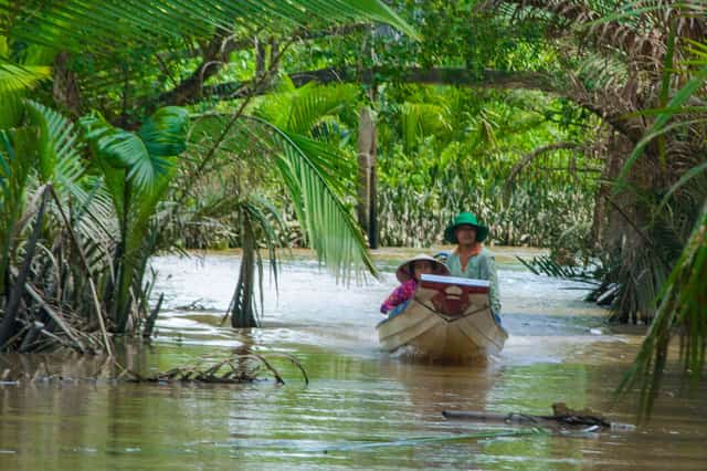
Cockle on Truong Tien canal.
Mr. Phan Van Lu said: "Actually, in this area, my foundation is already high, but this is the highest place! And wandering around in the garden, when I go back and open ditches, I sometimes find old things like clay bowls and braise pots made of terracotta or ceramic. My grandmother told me, back then, every time the mandarin walked on the road or in the river, there were bells and drums... Whose house passed by, that house had a mat to bow to the mandarin?!".
Visit the "former mandarin fort", comparing with the map "Nam Ky - Soc page 1889" extracted from the French national digital library Gallica BnF fr... we speculate: "Is it possible that the ancient Dao Tran Di was here"? Dao, a military post that protects and regulates the peace - larger than "ton" is a small post stationed at the river mouth, larger than "thu" is a military post that controls the trading port. Isn't it unreasonable that Di Dao Town was located here in the past?
Walking around the cool shores, sticky rice banks, dikes..., we met Mr. Lam Van Bul, who this year has been "an eighth person" in An Thanh 2, passing through the island since "nine years". Mr. Bul said: "At that time, the land in this area belonged to "Landlord Van", the old grandparents came here and chose a plot that had not yet been exploited by anyone, then built a foundation, built a house, and raised the rice fields. After clearing the land, the landowner measured it and then I paid the rent. It was calculated for 1 labor per 1 bushel. By the time of "near acquisition" this section of leafy forest and cork forest was still dark. On the high land, we cultivated fields, sweet potatoes, cassava, cassava...".
A person who can be considered a "senior" in Cu Lao Dung is Mr. Ba Ngo (Duong Van Ngo), the grandson of Mr. Council Ke - the father of landowner Mai Phat Van. He mentioned the old story clearly: "Mr. Council Ke is a council man in Dai Ngai. To say it now, it's like "doing state work" so he is familiar with land reclamation papers. If no one had registered the land on this side, he applied for an urgent application "from the edge of that canal to the canal below" and then paid taxes to the state. The old people here at that time were few. The majority living on the banks of the river were people from Vinh Binh and Tra Cu (Tra Vinh) who came to live in the lake. The farm land already has a landlord. If you come here, you can get more income from leaves and firewood. The new land has a lower tax rate, so it's easier to live. In the past, my grandfather rented a lot of land, but he didn't have the qualifications to measure the land, so he hired a "French guy - a wife". When the harvest season comes, it has a palanquin, with a dozen or twenty farmers sharing it to measure the land and collect rice... Back then, the land was low and low enough for two fishing boats to carry rice, not "squeaky" like now.
The fruit tree is still green amidst the "salty - sweet rotation"
The town is located right at two large river mouths flowing into the sea of the Hau Giang stream: Tran De and Dinh An (in the past there was also Ba Sac gate), so on all sides there is water with two large and low water streams, occasionally adding "nursery water" so the residents here have long been familiar with the ups and downs of the water to build bags and banks to open up land for cultivation. The area at the beginning of the island occupies the entire An Thanh 1 commune, the orchard is covered with longan, rambutan, coconut... Along the way, the garden is interwoven with sugarcane fields, crop fields and later shrimp fields... The water in the river, in the canal or on the canal in this country keeps rotating: "When the water is high, it is salty and when the water is low, it becomes sweet". Because of this characteristic, every garden, every field, every field has a system of ditches and tanks to store and regulate water to proactively irrigate. Just about twenty years ago, "Cu Lao Dung sugarcane" was famous for both its output and sugar, but now it is "fading". But from 2000 until now, we have switched to putting sugar cane in the garden with all kinds of fruit trees following the "plant - chop" movement?! The trees on the island grow quickly and bear fruit quickly, so you only need to "eat 2-3 seasons" to have enough capital to "follow the market economy"?!
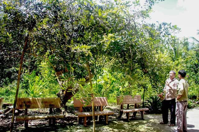
Mr. Sau Phuong next to the longan tree with "5 hands" are 5 different varieties of longan.
There must have been a chance, so I went to the garden of Mr. Sau Phuong (Le Thanh Phuong, 66 years old) in Phuoc Hoa A hamlet, Cu Lao Dung town. He is a resident of Cho Lach (Ben Tre). "His military career made him meet her on the island" and after being discharged from the army, he settled here in the 90s of the last century. With more than 20 square meters of land, he divided the area to grow 3 types of crops with the goal of "taking the short and raising the long - there will be something to sell in every season". Sugarcane, coconut and longan are the main crops. Surrounding the yard are longans and boxes of honey bees...
He excitedly told us: "When the longan garden had just been harvested, the price of longan on the market was very high! For every full tear, it was like I pocketed 2 taels of gold." Sugarcane prices going up and down have very little impact on Sau Phuong's income because there are still other sources of additional income. After 2000, he had more benefits from honey. Initially, there were 50 boxes and then gradually increased to more than 100. He also bought enough filtering machines, cleaning systems, and bottling systems to produce products with his own brand. There were years when the honey output he collected was more than 5 tons!
He revealed his experience growing trees in this estuary land: "As long as you don't let the seedlings suffer from "salt shock", the plants will gradually adapt to the soil and water?! Look at the water level to calculate the high threshold for flooding. Look at your land to calculate the height and width to place the seeds. The surface of the beds will gradually raise when the ditch slugs will push the tree roots to grow wider and less deep. If there is drought - salinity outside the canal every year or ten - half a month, don't rush to water. Just close the bags carefully to keep the water moist. Water quickly to avoid "salt shock". When the tree spreads strongly, it's like the tree has "got used to salt"?!
Perhaps this is also the experience of farmers in this country when along the "island axis" route down to An Thanh Nam, there are many gardens of four precious mangoes, Taiwanese mangoes, Thai jackfruit and even dragon fruit that are green and bearing luxuriant fruit.
The old story "words - meanings"
The place name Cu Lao Dung (Ho Chau) is recorded in Dai Nam thuc luc chinh bien, 1st century - Gia Long Dynasty (Nguyen Phuoc Anh): 8th year of Dinh Mui - 1787 - "The king resided in Ho Chau, gathered more than 300 generals, more than 20 warships, ordered Nguyen Van Ton to gather several thousand people from the two regions of Tra Vinh and Man Thit, and appointed them as soldiers, called Xiem Binh station (in the 9th year of Gia Long's reign, it was changed to Uy Vien station), making Ton the chief of the internal team to manage.
The character "Chau" (州) - the cross with 6 strokes is both pictographic and converging. According to the new Sino-Vietnamese dictionary of Nguyen Quoc Hung, Khai Tri Publishing House in 1975, the word "Chau" is "a large area of land emerging between rivers and seas, habitable, the name of an administrative unit in the past." "Tiger" - in addition to meaning tiger, is also a word used to describe the shape of an object, a shape with the phenotype of a tiger. The Thieu Chuu dictionary explains this word as follows: "Anything that looks like a mouth turned up to one side is called a tiger. Like the space between the thumb and index finger is called tiger mouth. Therefore, pressing the knuckles to calculate numbers is called one tiger. The way of playing chess with three pieces standing in three corners is also called tiger." Looking at the old and present maps, you will immediately see that Cu Lao Dung is no different from the open hand with "the tiger mouth is Ba Sac gate" (now Big Vam Ho - Small Vam Ho)?!
Then “Huynh Dung Chau”. The word Dung - 10 strokes, water set, in addition to the common meanings of: melting, dissolving, circulating, also has other meanings of mixing, spacious, vast, immense. Nguyen Quoc Hung's dictionary has the annotation "Immense water shape". Currently, Cu Lao Dung Island has more than 260 canals, canals, and rivers flowing to the sea, cutting across and cutting along this island. Just the names of places, names of things, and phenomena here also make visitors curious about which ones are: large pond, deep pond, dike bank, embankment bank, fishing bank, sticky rice bank, big water, low water, small water, seaweed water, jerky water...
In the midst of vast waves of water, Cu Lao Dung has three natural ecological zones: fresh, brackish and salty. In addition to fruit, the specialty of this country must be "cork flower honey" with a light green color, mild sweetness and a slightly sour taste. Currently, although there is still "a long way to go", soon when the Dai Ngai bridge is completed, Cu Lao Dung will surely transform into a "pearl island" at the end of the Hau river. But even then, I still firmly believe that when "Returning to An Thanh" people will still remember deeply: "The bright sunlight of children's laughter. The bright sunlight of your radiant lips. The river flows like silk, smooth with alluvial life. The spring wind took the boat to the wharf. How can you remember before you leave... An Thanh?"
Can Tho 7166 view
Update day : 23/10/2023
Source : baosoctrang.org.vn Affiliate links

Monuments close by
See all
Tam Vu Victory Relic
Tam Vu Victory Relic Area is located in Xeo Cao hamlet, Thanh Xuan commune, Chau Thanh A district, Hau Giang province. The glorious victories of the four ancient Tam Vu battles that took place on the Cai Tac - Rach Goi road section, less than 5km, were a brilliant highlight in the resistance war against the French colonial invaders of our army and people. After September 23, 1945, the Saigon - Gia Dinh army opened fire against the invading French colonialists, opening the Southern resistance war, then on October 30, 1945, the Can Tho army and people became heroic in their resistance against the French colonialists. recaptured Can Tho. After 90 days of siege and attrition, destroying the French army in Can Tho town, Le Binh's suicide squad disguised itself and gathered at the French command post in Cai Rang on the morning of November 12, 1945. Wounding many enemy soldiers, including the wounded officer of Rouen, terrified the French soldiers. With courage, the Republican Guard unit commanded by comrade Nguyen Dang on January 20, 1946, attacked the enemy's military convoy on Tam Vu Highway, destroyed 2 military vehicles, and killed a number of enemy soldiers. including Dessert, commander of the French expeditionary force in the West, one of five high-ranking French officers on the Indochina battlefield. We confiscated 10 guns, including 2 medium machine guns. The Battle of Tam Vu 1 had a very important meaning, this was the first victory of our armed unit against enemy motor vehicles, opening the door for the next battles on the Can Tho battlefield. Less than a year later, Can Tho's army and people continued to win the battle of Tam Vu 2, on November 12, 1946, commanded by comrade Ngo Hong Gioi, ambushing the enemy's military convoy on Tam Vu Highway. , destroyed 3 vehicles, killed 60 French and Le Duong soldiers, collected 60 guns of all kinds and many other military equipment and supplies. After the day of "National Resistance", implementing the directive "All People's Resistance" of the Party Central Committee's Standing Committee (December 19, 1946) and the call of beloved Uncle Ho (December 20, 1946). The all-people and comprehensive resistance war has developed strongly, Can Tho's army and people have achieved many victories, especially the activities of the "Party Assassin" teams, Rangers, and armed police to destroy enemies and evildoers. The storm in the inner city of Can Tho made people confused and afraid. At this time, the Tam Vu 3 battle took place on May 3, 1947, commanded by Minister Huynh Phan Ho, also on the old Tam Vu route. Our army and people destroyed 6 military vehicles, killed and injured nearly 200 French soldiers, and captured 8 machine guns, many guns and ammunition of all kinds, as well as military equipment and supplies. The Battle of Tam Vu 3 was a victory of heaven, earth, and people. When we returned to camp at Lang Ham to prepare for the Battle of Tam Vu 3, a squad of Khmer soldiers came in to cut down trees and were forced to destroy them. Our troops withdrew as a diversion, only 10 days later they returned to hide their troops, continuing to fight the Tam Vu 3 battle without being exposed, because the people protected the soldiers to defeat the enemy. Victory after victory, just one year later, the beautiful coordination of three types of troops (main force, local army and guerrilla militia) created a heroic miracle, continuing to win the battle of Tam Vu. 4, took place on the afternoon of April 19, 1948, under the command of Minister Tran Van Giau and Chief of Staff Vo Quang Anh, our army used the tactic of occupying and attacking, destroying 14 enemy military vehicles, killing Nearly 200 French soldiers, including one Quang Ba, collected many guns and ammunition, especially the 105mm cannon for the first time in the country, resounding throughout the Indochina battlefield. With the profound meaning and scale of victory of the 4 Tam Vu battles, the golden book of our nation's revolutionary tradition against invaders has become even more brilliant. Therefore, the Ministry of Culture and Information recognized the Tam Vu victory site as a national historical-cultural relic on January 25, 1991. Source: Hau Giang Province Electronic Information Portal
Can Tho
10814 view
Rating : National monument

Can Tho Grand Examination
The Can Tho Grand Prison historical relic is currently located at No. 8, Ngo Gia Tu Street, Tan An Ward, Ninh Kieu District, Can Tho City. To serve the ruling apparatus in Can Tho, from 1876 to 1886, the French colonialists promoted the construction of many agencies and offices... including a prison named "Prison Provinciale". The prison was built on an area of 3,762 square meters, adjacent to the Governor's Palace, opposite the Administrative Building and separate from the residential area, people often call it Can Tho Grand Prison. When the Geneva Agreement was signed in 1954, the Saigon government changed the name of Can Tho province to Phong Dinh province, and the Can Tho Grand Prison was renamed the Correctional Center. But no matter what name it is called, Can Tho Grand Prison is essentially a hell on earth - a place where imperialist colonialists imprison and exile our revolutionary soldiers and patriotic compatriots. The Big Examination Gate has an arch shape, on the left of the gate is the office of the on-duty supervisor, on the right is the office and residence of the chief supervisor. The large prison is surrounded by a wall from 3.6m to 5m high, covered with pieces of bottles and barbed wire. At each corner of the wall is a 6m high watchtower with guards and floodlights at night to control prisoners. Inside the large prison, there are 21 collective cells and many solitary confinement cells. Between the prison rows is a large yard for prisoners to sunbathe. In this yard, the colonialists and imperialists also built pagodas and churches to show respect for the prisoners' beliefs and religion. Around 1963, two rows of buildings were built on the yard behind the temple, the ground floor had no walls - for a time it was used as a vocational guidance house for prisoners... The prescribed capacity in each collective cell is only about 30 to 40 people, but sometimes the number of prisoners reaches 70 to 80 people. Especially after the Southern Uprising, the enemy crazy used all tricks to terrorize and take revenge on our people. Many leaders, party members and the masses were imprisoned by the French colonialists at the Can Tho Grand Prison. In addition, the enemy also brought hundreds of people participating in the uprising and leading comrades in the provinces of Soc Trang, Bac Lieu, Ca Mau... here to detain and brutally torture them. Especially during the period when US imperialism used the "Law promulgated by the Republic of Vietnam regime on May 6, 1959 to terrorize and restrain our people, arresting all those suspected of being "Viet Cong", At this time, the number of prisoners in each room sometimes reached more than 100 people. Many prisoners could not endure the regime of imprisonment, torture, and harsh food and had to slowly die in this dark prison. The remaining people were infected with all kinds of diseases: scabies, malaria, typhoid, tuberculosis... For special political prisoners, the enemy was locked up in solitary confinement cells, tortured to the point of paralysis but still alive. loyalty to the Party and the people, keeping integrity until the last breath. Despite extreme torture, the Party comrades in prison still had Party Cells, Party Committees, study activities, and organized struggles with the enemy every hour and every minute, resolutely preserving revolutionary qualities. It is the indomitable fighting spirit and patriotism of political prisoners that has inspired and enlightened the revolution by many prison guards and guards, and they volunteered to be our internal base. Inform political prisoners of our situation and the enemy outside to take precautions or have strategies to fight the enemy in prison. The South was completely liberated, and Can Tho Grand Prison became a deeply engraved evidence of the indelible crimes of colonialism and imperialism. It is here that so many outstanding people from their hometown of Can Tho and neighboring provinces have fallen to contribute to writing the glorious and heroic history of the nation. On June 28, 1996, the Ministry of Culture and Information ranked Can Tho Grand Prison as a national historical relic. Source: Can Tho tourism information portal
Can Tho
10248 view
Rating : National monument

Pothisomron Temple
Pothi Somron Pagoda is an ancient Khmer pagoda located on the O Mon river, in Chau Van Liem ward, O Mon district, Can Tho city. The pagoda was recognized as a city-level historical and cultural relic in 2006. In the pagoda's grounds there are many trees, including a tree called Somron, so the pagoda was named Somron. Initially, in 1735, Pothi Somron Pagoda was only built with simple materials such as leaves and bamboo. By 1856, the pagoda was built with precious woods such as spokes, ca ca, Thao lao and covered with fish-scale tiles. 100 years later, the pagoda was degraded, Venerable Thach Khieng - Abbot of the pagoda from 1950 to 1988 went to Phnom Penh to request a new design from famous architects of Cambodia, on the basis of preserving traditional architecture. system. Construction on the new pagoda began in June 1950 and was completed in 1952. This architecture is kept until now. The pagoda has one side facing the gate of the Khmer Theravada Buddhist Academy, the other gate is close to the gently flowing O Mon River with a cool water wharf. The main hall is a prominent building in the architectural complex of Pothi Somron Pagoda, built in the East direction. Khmer people believe that although Buddha is in the Western world, he always looks towards the East to save sentient beings. The steps leading up to the main hall have a sophisticated Buddha statue meditating. On the wall are drawings depicting the life of Buddha presented very vividly. The images of the nymphs Kennâr and the god bird Krud are carved so high as to support the tile roof. The main hall's roof has three overlapping levels, with a dragon image running along the edge of the roof with its tail reaching straight up into the sky. The columns, fences, door frames, roof tops, and walls are all meticulously carved with geometric and water hyacinth patterns. Khmer pagodas all have core towers, but perhaps there are few pagodas that can preserve a more than 200-year-old tower like Pothi Somron Pagoda. The bone tower is right in front of the main hall, built of umbrellas, laterite, and bricks dating back to the 18th century. Inside this tower are the remains of many Buddhists and have been preserved for many generations. According to Venerable Dao Nhu, abbot of the pagoda since 1988, said: some Buddhists asked to rebuild and renew the outside of the tower, but the pagoda did not agree, because this is evidence of the pagoda's history and culture. nation's culture. The pagoda currently preserves many antiques. These are wooden swallow wings made in 1856 carved with images simulating stories about Shakyamuni Buddha, more than 100 sets of Satra sutras (leaf books), 17 wooden statues nearly 200 years old. The Buddha statue in the Center of the Main Hall was carved in 1885. During the two resistance wars against the French and the Americans, Pothi Somron Pagoda supported and sheltered many young people who escaped the military draft of the old regime. Many monks and monks of the pagoda, after returning from secular life, became party members and union members. Typical examples include Mr. Dao Sang, Chief of Police and Mr. Dao Ca, Chairman of the Dinh Mon Commune Resistance Committee in the years 1945 - 1948. For nearly three centuries of existence, the ancient temple is still dignified and pure, many monks have studied here, there are monks with high virtue and great merit, such as: Venerable Dao Nhu, practicing at Pothi Som Rom was 12 years old and became the abbot of the temple. Up to now, Venerable Dao Nhu is making great contributions to the sect and church as the new leader of the Khmer Theravada Buddhist Academy. Today, Pothi Somron Pagoda is the origin of many social and cultural activities launched by the Vietnam Fatherland Front Committee of Can Tho City, the Buddhist Association of Can Tho City and the Department of Culture, Sports and Tourism. Source: Western Travel
Can Tho
10176 view
Rating : City-level relics

Temple of the Lady of My Dong hamlet
My Dong Ba Chua Xu Temple is located in My Dong hamlet, My Quoi commune, Nga Nam town (Soc Trang). This place is associated with many important historical events of a heroic revolutionary land. Going back in history, My Dong hamlet, My Quoi commune was once a vast, empty land, crisscrossed with rivers and very deserted. At that time, My Dong Ba Chua Xu Temple was built on a foundation about 40cm high, with an area of 2,400m2. The temple is built of bricks, roofed with tiles, divided into 2 compartments, the first compartment worships Ba Chua Xu and her predecessors and descendants, the back compartment is used as a kitchen to prepare worshiping ceremonies. Before 1930, the uprising movement against the oppression and exploitation of the French colonialists and the henchmen of the American Quoi people continued but was not strong. In early 1930, comrade Quan Trong Hoang, a party member, returned to My Quoi village to organize propaganda and foster revolutionary theory for elite youth. From that human resource, in June 1930, the first Vietnamese Communist Party cell of Soc Trang province was established at My Quoi market with comrade Chau Van Phat as secretary. In a short period of time, comrade Chau Van Phat divided his thoughts, prayed for peace, was not steadfast in his stance, forgot his duties, and was disciplined. After that, the superior party organization nominated comrade Tran Van Bay as Secretary of the Party Cell and took My Dong Ba Chua Xu Temple as the location for cell cell activities. In the form of public activities such as organizing martial arts classes, teaching ancient music, teaching the national language... many secret training classes are continuously opened by the Party cell, secretly propagating the revolutionary line, recruiting many members. elite youth joined the Party, thereby promoting the growing development of the local revolutionary movement. After the uprising on November 23, 1940 throughout the provinces of Cochinchina, the French colonialists frantically launched large-scale raids to take revenge on the patriotic revolutionaries. The Temple of Ba Chua Xu in My Dong was also destroyed and leveled by them... It can be said that My Dong hamlet, My Quoi commune is not only the cradle of revolution, where the first Communist Party cell of Soc Trang province was established, but also the revolutionary base of agencies such as: District Party Committee and other organizations. Departments of Thanh Tri district, the Provincial Party Committee's Propaganda Department, the Department of Military Affairs, Communications, Kinh Tai, Civil Military Medicine, the Music and Dance troupe of Soc Trang province and a number of departments of the Bac Lieu Town Party Committee. During the resistance war, many times the French colonialists and then the American imperialists poured bombs and bullets to wipe out the revolutionary forces but still could not shake the iron spirit of the soldiers and people of this heroic countryside. The revolutionary base here was still maintained until April 30, 1975. According to the uncles at the Veterans Association of My Quoi commune, through the two resistance wars against the French colonialists and the American imperialists, many outstanding children of My Quoi's homeland were awarded and posthumously awarded the title of Hero of Strength by the State. People's Armed Forces, with more than 100 heroic Vietnamese Mothers. Through the rain of bombs and bullets during the war years, after the country was at peace, people in My Dong hamlet together rebuilt a temple made of bamboo, wood and thatched with leaves to worship and pray for their homeland. With favorable weather and wind, everyone has a peaceful and prosperous life. In 1997, the province invested funds to build a memorial stele where the first Vietnamese Communist Party cell of Soc Trang province was established. Every year, My Quoi people organize the Ba festival on the 16th day of the second lunar month. On November 27, 2003, Ba Chua Xu Temple in My Dong was ranked by the Ministry of Culture and Information as a National Historical-Cultural Monument. Source: Soc Trang Online Newspaper
Can Tho
9945 view
Rating : National monument

An Nam Communist Party Red Flag relic site
On the night of November 10, 1929, in a hut across the rice paddies of Co Do plantation (in Thoi Dong village, Thoi Bao canton, O Mon district, Can Tho province), comrade Ha Huy Giap - Member of the Executive Committee of the Special Committee for Security The Southern Communist Party of Hau Giang was assigned by the Special Committee to O Mon in coordination with comrade Nguyen Van Nhung and comrade Bay Nui to establish the An Nam Communist Party Cell, with comrade Ha Huy Giap as Secretary. The Annam Communist Party Cell of the Red Flag Party propagated and campaigned to raise revolutionary enlightenment for a large number of working farmers, guided the fight for their rights, and actively selected the masses to join party organizations. The Party cell quickly promoted the building and development of grassroots party organizations throughout the province to lead the revolutionary movement. The birth of this cell not only promoted the revolutionary movement in Can Tho but also had a strong impact on many localities in the region such as Dong Thap, An Giang... From the first Party cell, many other Party cells were established in the province... Mass organizations of the Party such as the Red Trade Union, the Red Agricultural Association, Youth, and Anti-Imperial Women were also organized in many places. , under the leadership of the party cells, gathered a large number of people and promoted the revolutionary struggle movement. To preserve and promote historical values, the city has invested in building a project to preserve, restore and promote the value of historical relics. Location of the establishment of the An Nam Communist Party Cell of the Red Flag Party with an area of nearly 40,000 square meters. The project was completed and put into use in 2019 right on the old plantation land, which is also the center of Co Do district today. The relic area is built in the style of an open park, with airy space, including items: monuments, reliefs, stele houses, squares, and lotus ponds. On October 31, 2013, the Ministry of Culture, Sports and Tourism decided to classify the location where the An Nam Communist Party Cell of the Red Flag was established as a national historical relic. Currently, the relic site is a place for sightseeing, studying, traditional activities, cultural and artistic activities, and sports for people of all walks of life and tourists from near and far. Source: Can Tho City People's Committee
Can Tho
9448 view
Rating : National monument
Nearby tourist attractions
See all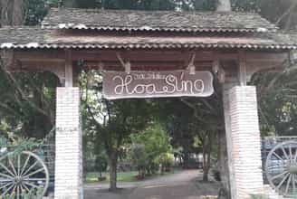
Water Lily Ecological Garden
Can Tho always attracts tourists with its rustic and simple beauty from nature to people. To fully explore this land of Tay Do, don't forget to visit the Hoa Water Ecological Garden. Hoa Sung Ecological Garden is located right on Highway 61B (the road connecting Can Tho - Vi Thanh), Ba Lang ward, Cai Rang district, only about 5km from Can Tho city center. The garden is more than 1 hectare in size, is a garden food court, serving Southern-style country dishes, along with recreational fishing and amateur music activities that will definitely bring relaxing moments. Great for visitors. When traveling to Can Tho, coming here, you can comfortably immerse yourself in the peaceful natural scenery of the Western garden. Water Lily Ecological Garden was built with a green, airy space, rows of coconut trees full of fruit silhouetted on the water surface, bunches of water lilies shimmering on the lake surface, lush jackfruit garden laden with fruit, a truly idyllic beauty. poetic. The path system in the Hoa Sung eco-garden is meticulously invested with old bricks and occasionally you will see the image of a cart wheel in a small corner of the garden that looks extremely rustic. In the eco-garden there is also There is a plank bridge next to the bridge for visitors to enjoy the breeze, as if evoking a peaceful childhood in a Southern village. Coming to Hoa Sung Ecological Garden, visitors not only feel the fresh, cool air of the orchard but can also relax by fishing for snakehead fish, giant fish... raised in the pond. After a moment of recreational fishing, guests can ask the gardener to process the "trophies" into their favorite dishes, then enjoy them under the thatched huts. Coming here, don't forget to enjoy delicious rustic country dishes such as: fried rice husk shrimp, grilled snails with pepper, eel with cilantro, grilled garden chicken with salt and chili, braised giant fish, braised snakehead fish, catfish. grilled, grilled snakeheads, boiled or stir-fried garden vegetables... One of the unique dishes that diners find hard to miss when coming to Hoa Sung is the fish sauce hotpot served with coconut vegetables, chopsticks or water lily. The attractive point of this fish sauce hotpot is that it uses fresh coconut water available in the garden to cook, thanks to which Hoa Sung fish sauce hotpot has a sweet taste, with a very unique aroma compared to other places. Most of Hoa Sung's typical dishes are made from fish raised in ponds, vegetables and fruits grown on site, ensuring "homegrown" criteria of freshness, quality, and hygiene. food production. To make the menu more diverse, in the floating season, Hoa Sung Ecological Garden also updates dishes made from specialties of ling fish, such as: crispy fried ling fish, braised or cooked sour...
Can Tho
8682 view
From January to December
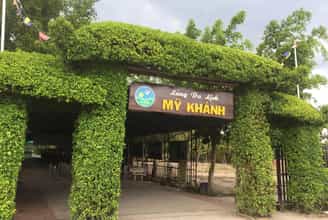
My Khanh tourist village
My Khanh Can Tho tourist area is located about 10km from the city center. The area of My Khanh tourist area is very spacious, up to more than 300,000 m2. This place opens up many unique spaces such as fruit gardens, ancient houses, fish ponds, canals and many interesting games. The route to My Khanh Can Tho tourist area is probably quite unfamiliar to many new visitors coming here for the first time. You can refer to the following transportation methods: By road: For tourists around the Can Tho city area, you can choose motorbikes, passenger cars, taxis... These means of transport are popular, convenient to travel and easy to control. Traveling by water: Traveling by cruise ship will definitely be a memorable experience. You can visit Cai Rang and Phong Dien floating markets, which are typical and interesting trading activities in Can Tho. If you are coming from a far away place, you should find places to stay to rest to complete your sightseeing and discovery journey. This will make your trip more meaningful by having a comfortable place to rest after hours of hard fun. The best time to visit My Khanh is from November to April next year. At that time, it was the dry season with beautiful golden sunshine, flowers and fruits were ripe with fruit gardens full of brightly colored fruits. This time is very suitable for sightseeing experiences or super beautiful scenery for you to enjoy super "virtual" check-in. The first thing to mention when introducing My Khanh Can Tho tourist area is the ancient Southern houses. The houses are all over 100 years old, built and presented according to the architectural style of ancient Southern people. Behind the ancient houses, My Khanh Can Tho tourist area also has a traditional craft village preserving the specialties of the Southern region. Visitors will be able to witness firsthand the steps of making rice paper, noodles or the process of making delicious wine. These will also be meaningful gifts for you to enjoy or buy as gifts for loved ones. Countless types of typical fruits of the West are available at My Khanh tourist garden, with all colors, each tree is laden with fruit. You will definitely be "dazzled" by the rows of mangoes, rambutans, jackfruits... planted along the path. Not only are they pleasing to the eye, you can also enjoy the delicious flavor of these fruits. What could be better than seeing and enjoying fruit right in the garden? My Khanh Can Tho tourist area is a space to enjoy Southern amateur music. These melodies are the traditional art of Cochinchina. In 2013, UNESCO recognized them as an intangible cultural heritage of humanity. Coming to My Khanh Can Tho eco-tourism area, tourists can also transform into landowners, "returning" to the ancient lifestyle with Ba Ba clothes, large houses and servants. The experience is also recreated very realistically when you travel by horse cart or wade through ditches to catch fish. My Khanh tourist village also surprises you with the bustling atmosphere of the racetracks. In particular, the grumpy piglets or cunning dogs are the main characters of the extremely thrilling and attractive contest. You can buy betting tickets for the "candidates" that you believe will reach the finish line the soonest. Besides, My Khanh Can Tho tourist area also has many attractive activities such as watching circus, fishing, watching 6D movies,... Tourists can witness impressive circus performances with their own eyes or bottle-feed the fish themselves. very interesting. It would be a pity to travel to My Khanh Can Tho and miss the culinary experience of the river region here. The dishes are all famous specialties of the Southwest river region. When coming to My Khanh Can Tho tourist area, don't forget to enjoy the specialties: grilled snakehead fish, fish sauce hotpot, noodle soup, braised perch, crab hotpot,...
Can Tho
8829 view
November to April

Lung Cot Lau eco-tourism area
Lung Cot Cau tourist area is one of the ideal eco-tourism destinations for those who love rivers and gardens. Lung Cot Cau tourist area is located in Nhon Nghia commune, Phong Dien District, only about 5km from Can Tho City Center towards Vi Thanh. With a rustic natural setting, imbued with the rivers and waters of the Southwest, cool air, surrounded by fruit trees along ponds and lakes, it attracts a large number of visitors. Lung Cot Cau Tourist Area is also identified as a cultural relic of the ancient Funan Kingdom. Coming to this eco-tourism area, in addition to visiting and enjoying dishes from garden fruits and specialty dishes of the southwest, visitors also have the opportunity to learn more about the ancient Oc Eo culture. The place name Bung Da Noi - Lung Cot Cau is a name that was formed not long ago, about 20 years or so from the coincidence of people digging ditches, planting beds, finding crabs, catching fish... in the valleys. Bau, natural ditches and discovered and picked up a number of pieces of porcelain, teapots, stone statues, and pieces of gold belonging to the Oc Eo culture. When in the 1990s, the Central Institute of Archeology sent a survey team to Nhon Thanh hamlet, Nhon Nghia commune, Phong Dien district to conduct exploration and excavation. Through the results of archeology and ancient documents and bibliographies, there is enough basis to confirm that, before the Chenla (Khmer), there was once an ethnic group with a South Asian Hindu civilization and culture. , lived, settled, and disappeared on the map of the Mekong River basin for quite a long time. Thanks to excavations, archaeologists have encountered many large wooden stakes in a number of ponds and ponds around the area, at a depth of 2 to 3 m under the layer of plant alluvium. In addition, they also discovered many green, rectangular shaped rocks that had been processed, "floating" in the pond of this relic. Along with relics made of ceramic, bronze, gold, and large fossilized animal bones, experts have confirmed that under the alluvial soil of Bung Da Noi - Lung Cot Cau over 1,500 years ago, there were Phu residents. Nam Co lived in a quite prosperous community. Why this kingdom fell to this day has no satisfactory explanation. From planting a garden and digging a fish pond, the host family decided to turn this place into a rustic, ecological tourist area associated with learning about history. In particular, when coming to the floating rock - Lung Cot Cau tourist area, in addition to visiting the orchard and enjoying Southern-style dishes, visitors can also experience becoming a true Western farmer. Digging ditches to catch fish, rowing canoes to pick vegetables, digging the ground to harvest cassava and dwarf tubers... Officially put into operation in 2015, Lung Cot Cau eco-tourism area has an area of more than 7 hectares, of which most are orchards such as durian and mangosteen (mainly) and the rest are other types such as Bon bon, mango, longan, rambutan, pineapple, orange, tangerine, avocado, guava, plum, banana, grapefruit, Ha Chau strawberry and vegetables... The rest is built an amusement park centered around a Large pond with fish, this is where visitors have a comfortable space to eat, drink and play together. Lung Cot Cau tourist area is open for free, only charging fees for food and some services. Coming here, you can participate in typical rustic games of the river region such as: walking on a bamboo bridge without handrails, canoe racing, tug of war, cycling on the monkey bridge... you should rent extremely comfortable Ba Ba clothes. roof to easily participate in fun activities. Among all the activities, duck catching and fish catching are vibrant games typical of Westerners that are loved and participated in by many tourists. You will be extremely excited to chase ducks in the field and scream when you catch them, wading into the ditch and splashing water to catch snakehead fish hiding in deep mud will be extremely interesting experiences. taste. With the obtained spoils such as perch, snakehead fish, etc., the restaurant will process them into attractive dishes: grilled fish, sour fish soup with a strong Southwestern flavor that everyone must love. Not only does it attract tourists by its charming and poetic scenery, this place also has a system of water houses and resorts with light, beautiful and airy architecture for visitors to rest and comfortably eat and drink. At the tourist area, they serve rustic dishes such as grilled snakehead fish, roasted pork, steamed chicken with dwarf roots (or leaves, crab leaves), crab hotpot, country fish sauce hotpot... Especially, there is Seasonal dishes such as: stir-fried durian flowers, mangosteen salad, rambutan salad, grapefruit salad or Sesbania seaweed shrimp... The dishes are affordable and have strong flavors of the western region. Lung Cot Cau Ecotourism Area is also a place to regularly organize cultural exchange programs, amateur music competitions and art programs to celebrate major holidays.
Can Tho
8250 view
From January to December
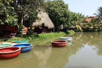
Bao Gia Trang Vien ecological garden
If you have the opportunity to travel to Can Tho, remember to visit Bao Gia Trang Dien ecological garden to immerse yourself in the green Western space and enjoy the fresh air. Participate in recreational activities of fishing, rowing basket boats... and enjoy Southern specialties. Bao Gia Trang Vien Ecological Garden is located at 268 Phu Quoi Area, Thuong Thanh Ward, Cai Rang District, only 7km from Can Tho city. With an area of about 20,000 square meters, Bao Gia Trang Vien ecological garden overwhelms visitors with its unique and ancient garden. In addition to beautiful bonsai trees, this place also has tall sala trees and many hundred-year-old star fruit trees. The space is airy and poetically beautiful with water lily ponds and swimming fish. The attraction at Bao Gia Trang Vien is that there are new adventure games, such as: basket boat swimming, mountain climbing, aerial games, off-road racing... Among them, slapping ditches and catching fish is a popular activity. most loved by tourists. It was fun when the whole group got covered in mud, becoming real Western farmers catching fish hidden under the mud. Not only can you play freely and have lots of laughter, but you can also enjoy rustic Western dishes from fish you catch yourself. You can rent a ba ba shirt and bandana when participating in this game and Bao Gia Trang Bien will equip you with traditional fishing equipment that is authentic to Westerners. In particular, there is a clean vegetable garden, a melon garden (Japanese Taki variety), and Gia Lai forest vegetables for visitors to harvest and prepare dishes. The spacious campus at Bao Gia Trang Vien is suitable for organizing picnics and team games. With many diverse activities: folding coconut leaves, five-fruit tray, learning to make folk cakes, making rice paintings, learning to sing amateur music... it will definitely leave unforgettable impressions in the hearts of visitors. Bao Gia Trang Vien Ecological Garden also has a lovely homestay area with a view of the romantic river, making it an ideal place to stay for tourists.
Can Tho
7750 view
From January to December
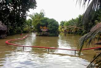
Xeo Nhum ecological garden
Currently, in Can Tho city there are many garden tourist destinations, including Xeo Nhum Ecological Garden which is a favorite place for many tourists. Because this place has healthy trees and sweet fruits, the space is quiet, suitable for visitors to relax and rest after stressful working days and noisy city life. Xeo Nhum Ecological Garden is located in Hong Loan residential area, Hung Thanh ward, Cai Rang district. Just leave Can Tho, run along Highway 1A toward Soc Trang for more than two kilometers to arrive. With an area of over 2 hectares, Xeo Nhum pleases visitors with its green space of gardens, fish ponds, gardens and beautiful flower fences. The highlight of creating the Xeo Nhum ecological garden is the shady perennial longan trees, next to the cool, romantic rows of green bamboo. The scene in the garden is very poetic, idyllic, rustic with trellises of gourds, luffa, bitter melon, water docks, nets, and rowing boats familiar in Southern villages. The food area around the fishing lake is designed in an airy, quiet space. Sitting here, visitors can enjoy Western-style dishes: steamed bamboo chicken with grapefruit, mangosteen bamboo chicken salad, grilled yellow catfish young luffa salad, seafood grapefruit salad, steamed snails with bottle gourd, and cooked mackerel fish. Acorns... All are "homegrown" of Xeo Nhum, bamboo chickens are raised in the garden, fish are raised in ponds, gourds and luffa are planted in the vegetable garden. At Xeo Nhum ecological garden, you can also experience growing vegetables like a farmer. If you like, you can rent land (each plot area is 10m2, cost about 100,000 VND per month) to grow vegetables, care for them and harvest them yourself. Staff at the garden will take care of the area when visitors are not present. During harvest time, visitors just need to come pick and bring the fruits home, or they can ask the chefs here to process them on the spot into delicious dishes. In addition to the service of growing their own vegetables, visitors can dig ditches to catch fish, go fishing, hook up, catch snails... Especially and the unique mark of Xeo Nhum is the colorful homestays. The rows of colorful and lovely homestays create a very beautiful background for those who like to live virtually.
Can Tho
7923 view
From January to December
 AI Travelviet