
 vn
vn en
en ja
ja ko
ko zh
zh


Mù Cang Chải - My Return
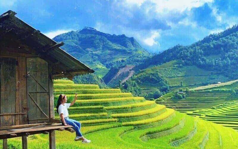
Last weekend, Mù Cang Chải district in Yên Bái province hosted an Ultra Trail Marathon, a truly grueling 85 km race boasting an incredible 6,000 meters of elevation gain. The challenging course, with its relentless ups and downs, wound its way through famous tourist attractions. Runners traversed iconic spots like the Mâm Xôi Hill terraced fields, the serene Bamboo Forest, the unique Corn House, and the beautiful Horseshoe terraced fields, all while conquering incredibly steep, seemingly endless slopes. Adding to the immense challenge, the route also plunged into deeply muddy and treacherous forest sections, snaked through aromatic cardamom fields, and passed directly through charming Hmong villages.
Mù Cang Chải Golden Season – Conquering Winding Roads, Welcoming Morning Mist, and Vibrant Ripe Rice Fields Amidst the Clouds
Last weekend, Mù Cang Chải district (Yên Bái) hosted an Ultra Trail Marathon race, covering a distance of 85 km and climbing a total elevation of 6,000 meters. The challenging up-and-down route passed through famous tourist spots like Mâm Xôi (Tray of Sticky Rice) Terraces, Bamboo Forest, Corn House, Móng Ngựa (Horseshoe) Terraces, and many other long, steep, eye-catching slopes. Sections through muddy forests, cardamom fields, and Hmong villages... all presented formidable challenges.
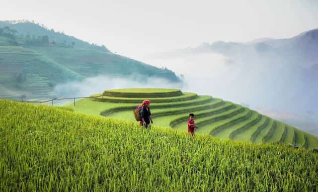
Early morning at Mâm Xôi Terraces
This period, from September until the end of October on the lunar calendar, is the Golden Season, marked by the Golden Season festival. During this time, the rice on the terraced fields ripens to a brilliant golden hue under the autumn sun, likely kept unharvested by local request to attract tourists. And as scheduled, we returned to the captivating Mâm Xôi and Móng Ngựa terraces, visiting the communes of La Pán Tẩn, Chế Cu Nha, and Dế Xu Phình, whether the weather brought rain, storms, or dazzling sunshine.
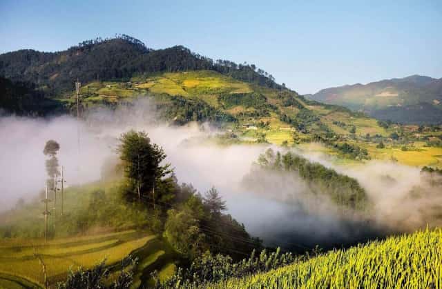
Early morning mist
Mù Cang Chải, in the local language, refers to villages and a land of dry trees (Mộc Khan Thổ – Dry Wood Land). It's unclear whether this name originated from forest fires or another reason. Located at an average altitude of 2,000 meters, beneath the Hoang Lien Son mountain range, 91% of its population are Hmong people, divided into four main groups: Black, White, Flower, and Red. About 300 km from Hanoi, the journey currently takes approximately 8 hours by car. However, in the past, it was considered an incredibly remote area, so much so that the phrase "Mù Cang Chải" became synonymous with "far-off place." During the Subsidy Period (Bao Cấp era), people would ask each other, “Where was your relative assigned?” The reply might be, “Oh my, after so much effort to get into that agency, now they're sending them to a super remote place, 'Mù Cang Chải.'” The implication was that the person was assigned to a very, very distant place, perhaps in the Central Highlands, Yên Bái, or Quảng Ninh – a place like Mù Cang Chải that they had never visited, and from which regular returns would be difficult.
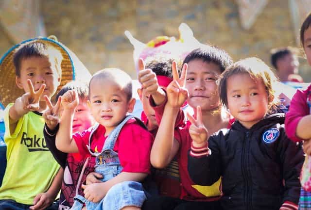
Mid-Autumn Festival with children in the village
However, in recent years, Mù Cang Chải has transformed from just a familiar name into a popular destination for many. Backpackers, whether by car or motorbike, are drawn to its winding, cloud-shrouded mountain roads. Groups on large displacement motorcycles ride in convoys. Photographers often stay up all night or spend all day under the sun, capturing shots. Colorfully dressed tourists flock here to 'check in' and capture moments of the radiant Golden Season or the high-altitude Hmong villages. And then there are groups, even individual foreign adventurers, who cycle or trek along the trails. More recently, numerous groups and organizations host mountain running races, like the one held last week.
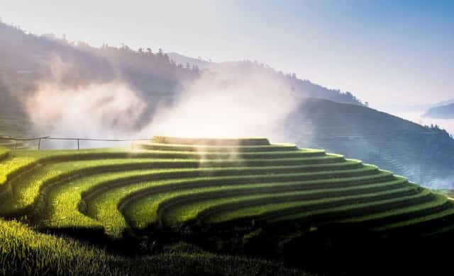
A moment at Mâm Xôi Terraces
We, a group of photographers, have been wandering through Mù Cang Chải every Golden Season for nearly a decade. Visiting once gives you a taste; twice brings a sense of familiarity; three times, it feels like an old friend. But the more you go, the more unique it feels, the more you want to explore, and the more you want to return, again and again. Each trip involves similar activities, but the varying weather conditions and different times of day or month always offer something new, along with the fortunate encounters of each journey. No one ever finds it monotonous, no matter how many times they visit.
This time, my first surprise among the many changes in the local area, the town's landscape, and its people, was the sheer number of *xe ôm* (motorbike taxis). It was truly striking. While Mù Cang Chải's *xe ôm* might not differ much from those in other mountainous regions, their impressive quantity truly stood out. “In La Pán Tẩn commune alone, a cooperative was established last year with 500 bikes,” H'Lú, a *xe ôm* driver from Mảng Mủ village near Corn House, told me. “If you include other communes, there are over 1,000 *xe ôm*!” he added. Can you imagine, 1.6% of the district's population (61,000 residents) are *xe ôm* drivers! In 2023, it's estimated that over 200,000 tourists visited Mù Cang Chải.

Capturing memories during the Golden Season
Why are there so many *xe ôm*? Who are they? Mù Cang Chải town is situated along National Highway 32, which runs parallel to the stream below. Nestled neatly between two mountain slopes are charming small villages, traditional Thái stilt houses, and now many new homes built by people from the lowlands, urbanizing the pretty town. Peeking through the clouds on both mountainsides are the famous terraced rice fields, interspersed with old-growth forests, pine forests, bamboo groves, and the cloud-shrouded rooftops of Hmong villages. Beyond Mù Cang Chải town, there are 13 communes that attract visitors: Cao Phạ, Chế Cu Nha, Chế Tạo, Dế Xu Phình, Hồ Bốn, Khao Mang, Kim Nọi, La Pán Tẩn, Lao Chải, Mồ Dề, Nậm Có, Nậm Khắt, Púng Luông. Each of these is a Hmong village high in the mountains. From the national highway, reaching these villages requires taking a trail, ranging from 7-15 km depending on the village, accessible only by *xe ôm*. This is why the demand for *xe ôm* among tourists has soared.
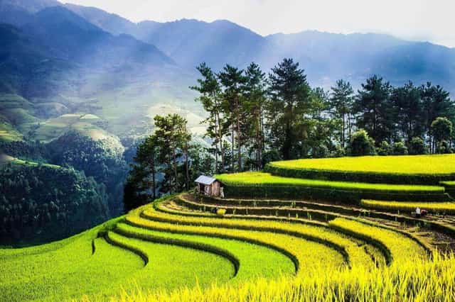
Horseshoe Terraces
While *xe ôm* aren't new here, having existed for many years, they were largely unregulated, despite some tentative local oversight. Now, the communes have taken the initiative to organize and establish cooperatives, with drivers in uniforms, designated management, standardized tickets, and fixed prices, ensuring order for both tourists and the service providers. On average, a round trip to each destination by *xe ôm* costs between 100,000 and 200,000 VND per person. “We *xe ôm* only get consistent work for about two months a year; after the season, there are very few customers,” shared H'Linh, a *xe ôm* driver who took me up to the Mâm Xôi terraces. “The road has been paved with concrete for the past two years, making it easier and safer to ride,” H'Linh replied as he navigated a turn, even though I had asked earlier. He could only answer once the bike had crested a steep incline and rounded a left curve downhill, allowing the engine noise to subside.
From the town, driving over ten kilometers on the national highway brings you to the foot of the mountain where the path to Mâm Xôi terraces begins. The climb from the base to the mountain is only about 1.17 km, but it's incredibly steep. Three years ago, it was a dangerous dirt and rock path with deep ruts for motorbikes. Now, it's a concrete road. Another path, about 1 km from town, serves as the access point for the Móng Ngựa (Mổ Dể) terraces and Bamboo Forest, involving a 2.5 km ascent up a sheer slope. This, too, has been paved with concrete, just wide enough for one motorbike. A bit further, a 7 km round trip leads to Kim Nọi commune, passing by the Háng Đăng Dê school.
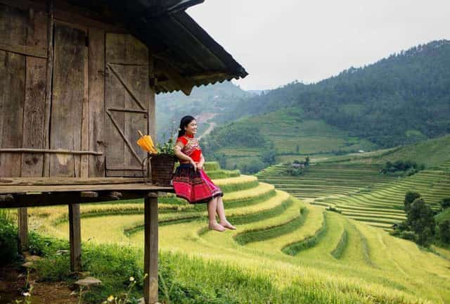
Capturing memories amidst the Golden Season
Most Hmong villages are nestled high in the mountains, at altitudes ranging from 800 to over 1,700 meters, perched on the slopes on either side of Mù Cang Chải town. “After the rice is harvested, threshed, and processed, is the grain carried down the mountain?” I once curiously asked some women who were threshing rice, surrounded by children gathered around a wooden drum that served both as a container and a threshing table. “Oh no, the grain has to be carried home, up there on the mountain!” one woman replied, wiping sweat from her brow. Following her pointing arm, I looked up at the cloud-shrouded mountain peak. Seeing the sacks of rice, it was hard to imagine carrying them up, especially since we had to hire *xe ôm* just to climb to this already high point. I had thought carrying rice *down* would be difficult, but now they were saying it had to be carried *up* to their homes…
It's not just rice, but also corn, cardamom, wild apples (*táo mèo*), and wild tea (*sơn trà*) – all produce of the mountains and cultivated fields – that are harvested from lower fields and brought back up to homes, sometimes dozens of kilometers away and hundreds of meters up steep slopes. H'Linh, a *xe ôm* driver, continued to take me from the national highway up to two spots: the Bamboo Forest and Móng Ngựa Terraces. “These two places share the same path, one way up and another way down,” H'Linh said as he shifted gears. The engine roared in first gear to conquer the steep incline. Compared to a few years ago, when it was a slippery dirt path with ruts just wide enough for motorbike tires, the concrete paving is a vast improvement, even though the road is only 50-60 cm wide, just enough for one motorbike. The edges of the road are gradually eroding from rain, and in many places, there's a sheer drop on one side and dense bushes clinging to the mountain face on the other. Despite this, the Hmong *xe ôm* drivers calmly carried their passengers upwards.
“Khúc khuỷu” (winding, tortuous) – you've probably heard this word. If you bend your arm, looking from your shoulder down to your elbow and then across to your wrist, that's exactly what the roads here are like. Climbing from the base to each mountain peak, these centuries-old trails feature extremely sharp, 'elbow-like' turns, just wide enough for courageous drivers to navigate, with inclines exceeding 45 degrees, keeping the engine constantly in first gear and roaring through the mountains and forests. “These are trails used by generations of Hmong people, carrying goods by horse or on foot,” H'Linh explained as the bike descended, making it less noisy. “Who funded the construction of these concrete roads?” I asked. “Some sections were built by the government, and others by the local people contributing their own money,” H'Linh replied.
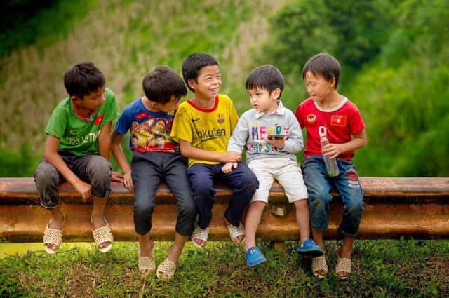
Hmong children
Many unique roads connect the villages, forming inter-commune routes that link cloud-shrouded mountain peaks. What's striking is that, despite each road having dozens of bends and folds from the foot to the peak of the mountain, they are almost invisible from below or from a distance. You'll rarely find photos of these roads, and one can only imagine how grand and impressive they would appear if seen. This is actually a good thing, as the roads wind beneath the canopy of lush forests – protective forests, natural forests, pine forests, or even the villagers' home gardens – all of which vibrantly cover the mountaintops.
The motorbike climbed higher and higher, almost to the mountaintop, where we reached the Bamboo Forest – a beautiful, lush green patch, as impressive as a scene from Zhang Yimou's film 'House of Flying Daggers'. Since it was only Friday, there were few visitors, so I explored the forest alone. “You came out so quickly?” H'Linh asked, surprised, seeing me return. “Usually, when guests go down there, we have to wait for an hour,” H'Linh added as he handed me my helmet. He was right; if I had been with a few other girls and our cameras, we probably would have spent the entire day just at this one spot!
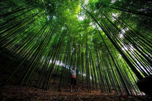
Bamboo forest
The motorbike then descended, still navigating many turns, but now on the other side of the mountain towards the Móng Ngựa terraces. “Last week, during the race here, did they run on this path?” I asked H'Linh. “Of course, they went up and down the same slopes we just crossed,” H'Linh replied. “Did they look tired running?” I asked again. “Extremely! Everyone was drenched in sweat. They were mostly walking, not running,” H'Linh said, adding, “We also use this path to carry goods. Before, it was slippery, but now it's easier, especially with motorbikes, so we can get to the district market or home much faster.”
The Móng Ngựa terraces are nestled deep below, requiring the motorbike to descend through many mountain slopes to reach them. This means that after harvesting, the locals have to carry their produce back up a very long distance. Here, many photographers were setting up their tripods; they came directly from the road below, making their ascent of just over 2 km quicker. Tourists were also quite numerous, arriving at the stilt houses and photography spots. Everyone was waiting for sunset, as the sun slowly dipped behind the distant mountains. Many visitors from the south were especially excited by the scenery and the ripe rice fields bathed in the afternoon sun. Foreign tourists often travel differently, so they tend to avoid the crowds of Vietnamese visitors. Even in trail running races, since the Covid pandemic, a significant number of foreign runners have participated. For instance, at the recent VMM Sapa, almost 1,000 participants ran the 21 km distance, with 70% being foreigners! In Mù Cang Chải, foreign visitors often venture deeper into the Hmong villages, exploring cultural aspects and the everyday life of the locals. Most Vietnamese tourists, however, follow the crowds, 'checking in' at spots popularized by media and social networks for their photogenic qualities.
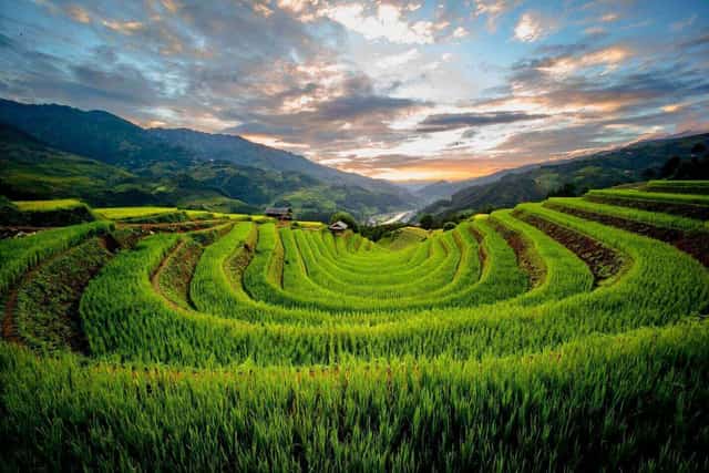
Móng Ngựa Terraces
I asked H'Lú, a *xe ôm* driver who took us through Kim Nọi village, located on the mountain opposite Mù Cang Chải. We crossed a bridge over the stream and then ascended, similar to the climb to Corn House. “Last week, they didn't run on this side, but they did the year before,” H'Lú replied when I asked about Sunday's race route. Our motorbike had to wait for a herd of buffalo to pass. I asked H'Lú, “What are the buffalo here raised for?” H'Lú replied, “For breeding and meat; farming is done by machine now.” According to H'Lú, agricultural products were usually transported by horses, but since he grew up, no one has raised horses for decades. Horses were friends and family, but raising them was hard work. “Rain or shine, cold or hot, you still had to go find grass and food for the horse, and care for it. Now, motorbikes make things much easier,” H'Lú added.
The livestock raised in Hmong villages are cold-resistant breeds, unlike those found elsewhere. They breed and reproduce them locally. “Project 135 provided each household with a buffalo, but after a year, they all died,” H'Lú recounted. During the cold season, they have to wrap and shelter their livestock, yet many still die in some years. Only local breeds can withstand the cold; if brought from elsewhere, they can't tolerate it and often end up 'on the kitchen shelf' (i.e., eaten).
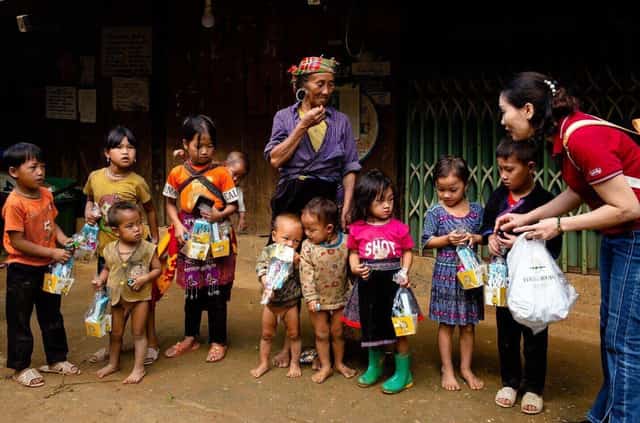
Children at Corn House
H'Lú's home is in Corn House village, on one side of the mountain, while Kim Nọi is on the other. “They’re about 15 kilometers apart, but you have to go up and down two mountains. In the past, visiting each other meant walking for an entire night,” he shared. He spoke of young couples who had to date this way. “Do people still ‘kidnap’ brides?” I asked, smiling. “No, now they just agree to marry and ride off on a motorbike; no more ‘kidnapping’,” he replied. According to H'Lú, children in ninth grade, around 14-15 years old, often marry and start families. “They just live together and wait until they are old enough to have a wedding ceremony,” H'Lú explained. Although underage, their parents allow them to live as a new family, with a husband, wife, and children. However, to get a marriage certificate, they must reach the legal age to register, and they can have a wedding if they wish.
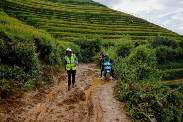
Road to Kim Nọi
“Do people from the lowlands come here to buy land?” I asked H'Lú. “Yes, they do,” he replied. “If they want land for trade or residence, they buy it in the district. But some buy land to cultivate wild tea (*sơn trà*), wild apples (*táo mèo*), or cardamom, and they often hire us Hmong people to work it.” I followed up, “Do Hmong people sell their land? Why would they need to?” What followed was a longer story. H'Lú explained that the terraced fields are inherited by entire clans and families. It takes many generations to cultivate them. “New fields are very rare; even if there’s land, diverting water isn’t easy,” H'Lú emphasized. The number of terraced fields reflects a family's wealth and status. However, if a family has an addict, they might have to sell their land. Families with many children also need to divide the land among them. “Now, each household only has a few small plots of land,” H'Lú said in a quieter tone.
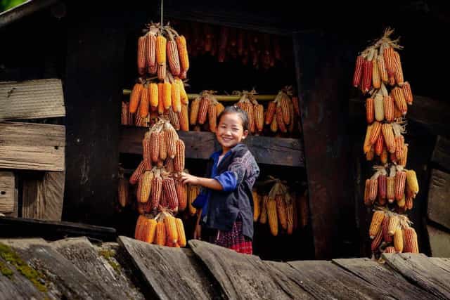
Child at Corn House
Not every family can afford a motorbike, and the *xe ôm* business only thrives for about two months during the golden season. During the 'pouring water' season (when fields are irrigated), demand is lower; it's mostly photographers who visit, with fewer tourists. “If there are motorbikes, why do so many people still have to carry goods up to the villages?” I asked curiously. “Many elderly people don’t know how to ride motorbikes, so they still have to carry their goods home,” H'Lú said, adding, “The elderly here often work harder than the youth.” Since the elders don't ride motorbikes, they wake up earlier, sometimes at 3 or 4 AM, to go down the mountain for work, returning home late at night after carrying their goods. For them, the concrete road only makes it less slippery; the steep slopes remain, and their lives essentially continue as before.
After the golden season, the Hmong people return to their usual labors, working in cardamom fields, wild apple (*táo mèo*) orchards, wild tea (*sơn trà*) gardens, or finding hired work on projects and constructions in the district below. Children from many families also leave to work as factory workers elsewhere. “My family has three children; my daughter went to work in a car factory all the way in Hòa Bình,” H'Lú proudly shared. With thousands of *xe ôm* drivers and hundreds at each mountain access point, whenever a tourist bus arrives, they rush to find customers, much like the old Mỹ Đình bus station. This is why the *xe ôm* cooperative was established and drivers were assigned numbers. Each driver can get a few trips on a weekend day, earning between 300,000 and 500,000 VND, which is quite high compared to their other work. The cooperative reportedly collects 20% per trip.
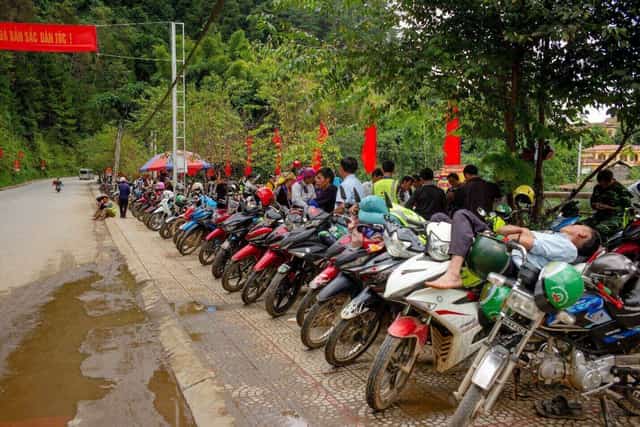
Xe ôm service to Móng Ngựa Terraces
“Is there a team to repair motorbikes that carry passengers up these mountains?” I asked H'Lú. “No, each driver repairs their own bike and covers the costs themselves,” H'Lú replied as he dropped me back at the station. Given the strenuous mountain-climbing activity, motorbikes wear out quickly, and breakdowns on steep slopes can be dangerous. Ensuring proper maintenance and readiness for each trip is a concern not only for the drivers but also a responsibility of the local authorities to guarantee tourist safety.
The terraced fields, with their glutinous rice ripening to a shimmering golden hue, stretch across every hillside. Visitors to Mù Cang Chải witness firsthand the green and golden 'sticky rice trays' (*mâm xôi*) emerging amidst the vast expanse of mountains and hills. Stopping at the three communes of La Pán Tẩn, Chế Cu Nha, and Dế Xu Phình, tourists will see terraced fields layered upon layers, spreading across all the hills.
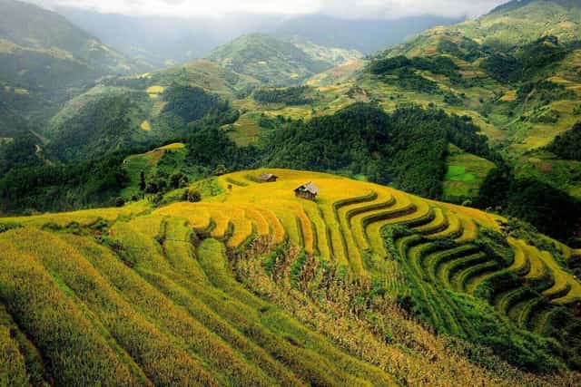
Terraced fields in Kim Nọi
Mù Cang Chải is still known as the “land of misty clouds, high mountains, and deep ravines.” Mù Cang Chải boasts a dense network of streams and gorges. Running alongside National Highway 32 is Nậm Kim, the largest and only river in the district, flowing southeast-northwest. Nậm Kim's waters murmur year-round, dividing Mù Cang Chải into its left and right banks, lending a rare, poetic beauty to the highlands. Additionally, Mù Cang Chải is home to many smaller streams like Nậm Hu, Nậm Mu, Nậm Muối, Nậm Có, Nậm Păng, Nậm Khắt, and Nậm Khót, all contributing to its cool, fresh climate. Alongside these streams and gorges are numerous multi-tiered waterfalls, famously including Nậm Mơ Waterfall (Mồ Dề) and Dề Thàng (Chế Cu Nha). Visitors can immerse themselves in the white, cascading waters.

The concrete road
Along both banks of the Nâm Kim stream, embankments have been built, and a rather poetic path runs between two bridges. After 8 PM, I enjoyed jogging along the stream, about 1 km in each direction. Along the banks, there are banked slopes that serve as natural seating for visitors to relax and admire the view. Couples of teenagers, still in their school uniforms, sat in various sections along the path – I guessed they were all Hmong.
Pú Nhu Waterfall is located 10 km west of Pú Nhu village in La Pán Tẩn commune. Originating from streams in the headwater forests of Than Uyên district – Lai Châu province, the waterfall features a steep drop with a 20-meter column of water cascading down multiple tiers. Mơ Waterfall in Mù Cang Chải district is nestled between the two hills of Nả Háng A and Nả Háng B, in Mồ Dề commune. On the journey to Mơ Waterfall, there are 7 impressive spots for visitors to pause and enjoy the scenery. From the district center, it takes about 30 minutes to walk to Mơ Waterfall. From there, visitors can continue to the single-tiered section where the water flows in a spiral pattern. To reach the four-tiered waterfall, visitors must trek further upstream, a truly breathtaking spot to capture beautiful photographs of Mơ Waterfall. Additionally, visitors can explore the caves in Nậm Khắt commune, conquer the mountain peak in Púng Luông commune, and discover the ancient stone field of Lao Chải.
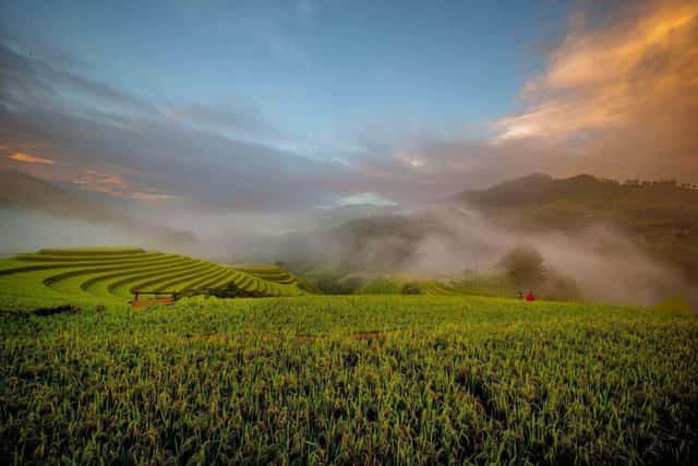
Sunrise over Mâm Xôi Terraces
Leaving the town, on our way back, we stopped at Khau Phạ Pass, known as the “Sky's Horn” Pass. It's one of Vietnam's “Four Great Mountain Passes,” alongside Mã Pí Lèng, Ô Quy Hồ, and Pha Đin. On Friday evening, a landslide occurred, forcing many photography groups and tourists to turn back to Tú Lệ to wait until Saturday noon for the road to clear before continuing. This pass is also a beautiful paragliding spot, offering flights above the golden season fields in the valley below. It's also a place we often visit to photograph the ripe rice fields below, but this time, the entire field had already been harvested. Perhaps the rice ripened earlier than usual this year?

Family making Cốm (green sticky rice)
In Tú Lệ, a place renowned for its *cốm nếp* (green sticky rice), local White Thái families hand-pound *cốm* for visitors. Every visitor passing through, before leaving Mù Cang Chải, desires a souvenir – at least some of these sweet green *cốm* grains, imbued with the sun, wind, and rain of the misty mountains, to take back to the lowlands. When one speaks of a place boasting the charming beauty of magnificent terraced fields, an air fragrant with sticky rice, and the pristine clarity of morning mist, they are undoubtedly describing Tú Lệ. This town is a valley nearly 3,000 hectares wide, nestled beneath the three mountain ranges of Khau Phạ, Khau Song, and Khau Thán.
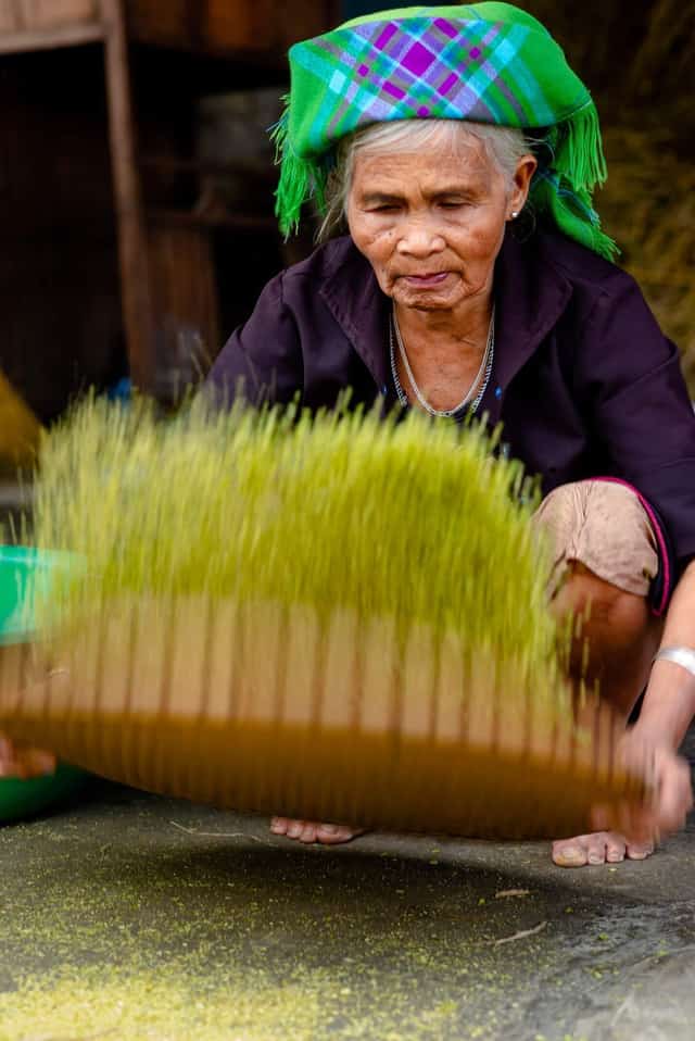
Tú Lệ green sticky rice (Cốm)
Leaving Mù Cang Chải, we promised to return next year during the 'pouring water' season, eager for new, distinct moments different from the Golden Season. To further discover the wonders that, no matter how many times you visit, always feel fresh and intriguing.
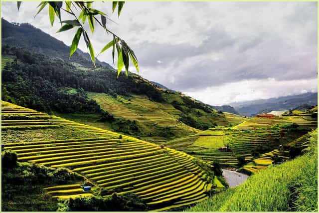
Terraced fields on every hill
Lao Cai 6306 view
Update day : 03/10/2023
Source : Báo Văn hóa và phát triển Affiliate links


Monuments close by
See all
Thuong Temple - Lao Cai
Lao Cai Thuong Temple is also named Saint Tran Tu. Lao Cai Thuong Temple was built on land in Bao Thang street, Chau Thuy Vi, Hung Hoa province, now Lao Cai ward, Lao Cai city, Lao Cai province. Thuong Temple was built during the Le dynasty, Chinh Hoa era (1680 - 1705). It is a place to worship the temperate Duke Hung Dao Vuong - Tran Quoc Tuan, who made great contributions in the career of protecting the country's mountains and rivers. A great historical celebrity, a sacred and noble Saint in the minds of generations of Vietnamese people. Located on Hoa Hieu hill in Mai Linh mountain range with an altitude of 1200m above sea level. Thuong Temple was built in the ancient architectural style of the letter Cong, following feng shui theory which is both majestic and very dignified. The Thuong Temple area has a charming natural landscape and a harmonious combination of traditional architecture and indigenous culture, giving the temple a majestic and splendid appearance. Reflecting on the Nam Thi river, this place once had an extremely important position in the defense strategy against invaders. Today, near the trade gateway between the two provinces of Lao Cai (Vietnam) and Yunnan (China), this sacred land at the tip of the Fatherland welcomes tens of thousands of domestic and foreign tourists every year. commemorate the national hero. Right from the moment they step foot at the temple gate, visitors can admire the beauty of a 300-year-old banyan tree spreading its branches, under the shadow of the ancient tree is a shrine worshiping Ba Chua Thuong Ngan (Queen of the Green Forest). Legend has it that during the resistance war against foreign invaders, she contributed to fighting the enemy to protect the territory of the South. To thank her, the people built a shrine right under the banyan tree with lush branches and leaves. In the main temple area, the horizontal painting "Land of Literature" is hung in front of the Nghi gate, on both sides there are two parallel sentences: "Vietnamese spiritual spirit is not built, Dong A's spirit lasts forever", meaning: " Vietnam's sacred monument stretches across the sky, the Tran Dynasty's pride remains forever. On the back of Nghi Mon's interior, there are the words "Quoc Thai and Dan An" with two parallel sentences: "Heaven and earth are gentle, heaven and earth are old; The golden flower grass is different, the money flower grass" means: "Heaven and earth are still the same, heaven and earth are old; The grass and flowers today are different from the grass and flowers of the past." Thuong Temple was built spaciously with 7 main worship spaces including: The Palace for worshiping Buddha Shakyamuni, The Palace for worshiping the Three Courts of Thanh Mau; Altar of Saint Tran Hung Dao; The palace worships the King and his father Ngoc Hoang... and the altars on the Left Vu - Huu Vu sides worshiping Lady Nhi Son Trang, Twelve Fairies, Attending God and the Temple Boy... are all arranged. placed in order. Next to the Thuong Temple is a square communal house with 4 doors and 8 flanking dragons. In the middle of the communal house is a golden turtle with a stone stele engraved with the name "Holy Tran". This place used to be a resting place for military officers on patrol. Today, it is an ecological forest with all kinds of plants to protect the environment, serving tourists to visit and rest to enjoy the fresh climate. Thuong Temple is located in a cultural relic complex with Tan Bao pagoda, Am temple, Mau temple, Cam temple, Quan temple. In particular, Thuong Temple is one of the most famous sacred temples in the system of temples and pagodas in Lao Cai. Through many restorations and embellishments, in 1996, Thuong Temple was ranked as a National Historical and Cultural Monument. Every year, Thuong Temple holds a festival on the 15th day of the first lunar month, attracting the attention of many domestic and foreign tourists to visit and worship. Source: Vietnam Tourism
Lao Cai
11380 view
Rating : National monument
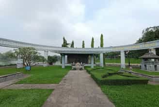
Nguyen Thai Hoc historical relic site
The grave site of Nguyen Thai Hoc and soldiers in the Yen Bai uprising in 1930, located in Yen Hoa park (30 hectares wide), Nguyen Thai Hoc ward, Yen Bai city, built in 2001 . Nguyen Thai Hoc was born on December 1, 1902 in Tho Tang, Vinh Tuong district, Vinh Phuc province. He was a patriot right from the time he was in a colonial school. He sent a letter to Governor General of Indochina Alexandre Varenne, a member of the French Socialist Party, calling for social reform in Vietnam. The Governor-General of Indochina did not pay attention to what Nguyen Thai Hoc suggested. On December 25, 1927, Nguyen Thai Hoc and his colleagues organized the establishment of the Vietnam Nationalist Party, and he was elected Chairman. The Vietnamese Nationalist Party was hunted down and arrested by the authorities. Faced with the risk of the Vietnamese Nationalist Party being broken up, Nguyen Thai Hoc, Nguyen Khac Nhu and Pho Duc Chinh decided to carry out a "general armed uprising". If you fail, it is also an example for the next generation to follow, "If you don't succeed, you will become a good person". The uprising force consisted of the Vietnam Nationalist Party, mainly red loincloth soldiers belonging to Companies 5, 6, 7, Battalion 2, 4th Tonkin Red Loincloth Soldier Regiment. Green loincloth soldiers did not participate in the uprising. On the night of February 9 to 10, 1930, the Yen Bai uprising broke out. The insurgent army killed most of the officers and non-commissioned officers in private houses, coordinating with the two-armed insurgent army and soldiers in the red loincloth station. 5 and 6 posts under rebellion. In front of the barracks yard, a representative of the Vietnam Nationalist Party read the article "Hit Uprising" with the slogans: "Drive the French enemy back to France. Bring the South back to the South. Let hundreds of them avoid suffering. More happy part". The flag of the Vietnam Nationalist Party flies above military camps and offices. Due to not being able to attract all the green loincloth soldiers No. 7 and No. 8 on the high station, the force was thin, so the insurgents were knocked out of their occupied positions, and the uprising was drowned in a sea of blood. Five days after the Yen Bai uprising, Nguyen Thai Hoc organized an uprising in Vinh Bao and Phu Duc, advocating to take over all of Hai Phong. The insurgents captured the district capital of Vinh Bao and killed district governor Hoang Gia Mo, a cruel and greedy mandarin. With a fierce counterattack by the French army with modern weapons, the insurgent army was destroyed. Nguyen Thai Hoc escaped due to the protection of the people. With a number of remaining prominent party members of the Vietnam Nationalist Party, Nguyen Thai Hoc discussed and planned to reform the Party and change the Party's strategic and operational direction. As soon as this policy was launched, on February 20, 1930, Nguyen Thai Hoc was arrested in Co Vit hamlet (Chi Linh, Hai Duong). On March 23, 1930, he was sentenced to death. On June 17, 1930, France sent Nguyen Thai Hoc and 12 other soldiers of the Vietnam Nationalist Party in Yen Bai to the guillotine. Stepping onto the scaffold, before putting his head into the guillotine, Nguyen Thai Hoc shouted: "Long live Vietnam!". France had to admit that the Yen Bai uprising had dealt a fatal blow to the colonial government. Nguyen Thai Hoc historical site marking the "Yen Bai Uprising" currently includes a mausoleum area, a monument area, a reception area, a memorial stele and a bonsai garden. Monument to Nguyen Thai Hoc and his associates during the Yen Bai uprising in 1930 at Yen Hoa Park, Yen Bai city. Most prominent in this area is the famous saying of Nguyen Thai Hoc, which became the main action motto and ideology of the Vietnam Nationalist Party, which is "If you are not successful, you will become a man", which was considered by the insurgents as a saying. swear to death. Although the Yen Bai uprising was not successful, patriotism is eternal. That's why, in our country, many places take the name Nguyen Thai Hoc to name avenues and schools. Mr. Phan Boi Chau wrote an oration about the Yen Bai uprising and the key figures of the uprising. Nguyen Thai Hoc historical relic site, Yen Bai city, Yen Bai province was recognized by the Ministry of Culture (now the Ministry of Culture, Sports and Tourism) as a national historical relic on March 5, 2019. 1990. Source: Yen Bai province electronic information portal
Lao Cai
10693 view
Rating : National monument

Mother Goddess Temple Lao Cai
Mau Temple is located in group 4, Lao Cai ward, Lao Cai city. The temple is located at the confluence between the Nam Thi and Red rivers flowing into Vietnam. This is also the international border gate of Lao Cai (Vietnam) - He Khau (Yunnan - China) and also the 102nd milestone in the Northwest border region. Mother Temple is a place to worship the Holy Mother Princess Lieu Hanh, a compassionate deity who exorcises evil spirits, helps poor people, and helps the court fight against foreign invaders and protect the sacred border areas of the Patriarchate. country. At the same time, she is a heroic mother in the folk subconscious of the Vietnamese people. The custom of worshiping Mother Goddesses in our country has gone through a long history. This is not only a worship custom imbued with national identity, but it is a common spiritual need of our people from the early period of building and defending the country until now. until today. Beliefs and customs of worshiping the Mother Goddess originate from the sense of ancestral remembrance, respect, gratitude, trust and have a profound moral educational meaning that is still of value to our generations today. . Holy Mother Lieu Hanh has been deeply imprinted in the subconscious of Vietnamese people in general and Lao Cai in particular since the 16th century. Through the ups and downs of history until today, our Vietnamese people have named her Mother Nghi. Thien Ha, always wish the Holy Mother to help "The world is peaceful - The country is peaceful and the people are peaceful - Phong Dang is in peace". Mother Goddess Lieu Hanh is a vivid symbol in daily life, but is very sacred in the mental life of Vietnamese people. In her subconscious, she is a Fairy, so she has Fairy magic; As a Buddha, one should carry Buddha's thoughts; As a Mother, she should have the qualities of a mother; is Holy so it is sacred; He is a child of good family, so he is educated, knowledgeable in history, and good at singing and poetry. In her, she has the filial piety of Confucianism and the magic of Taoism. That's why, Holy Mother Lieu Hanh is an image, one of the Four Immortals, the Mother of Heaven who has been reminded and educated to us for many generations: "In August, the anniversary of my father's death - in March, the anniversary of my mother's death." In Lao Cai, Mau Temple is located in the Thuong Temple Relics complex - a place to worship and remember the great contributions of the National Duke of Moderation - Hung Dao Dai Vuong - Tran Quoc Tuan. Mau Temple and Thuong Temple are also places with an important strategic position, a milestone in the Northern border of the Fatherland and a red address of the nation's historical and cultural roots. Mau Temple was built in the early 18th century, located in Lao Nhai village (now Lao Cai City), behind the temple is leaning against an ancient wall built by Liu Vinh Phuc insurgents to fight against foreign invaders. protect the borders of the land. Therefore, the Mau Temple was conferred three ordinations by the Nguyen dynasties: Tu Duc in the sixth year (September 24, 1853); Tu Duc in his 33rd year (November 24, 1880); Khai Dinh's 9th year (July 25, 1924). Located at the national border gate, on the international trade route, despite going through hundreds of years with many ups and downs of history, Mother Temple has not only become a sacred border landmark. Not only is it visited by people and tourists from all over the country and internationally, it is also a spiritual cultural milestone in the northern border region of the country. Mau Temple was recognized by the Ministry of Culture, Sports and Tourism as a National Historical and Cultural Relic on January 26, 2011. Source: Lao Cai province electronic information portal
Lao Cai
10643 view
Rating : National monument
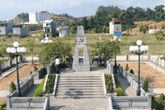
Cam Duong revolutionary base area
Cam Duong base area is located in Da 1 village, Cam Duong commune, Lao Cai city, Lao Cai province. Cam Duong and the surrounding communes of Xuan Giao and Gia Phu are lands rich in patriotic traditions and resistance to foreign invaders. The Cam Duong - Xuan Giao - Gia Phu guerrilla area played a very important role in the resistance war against the French in Lao Cai. That is the first resilient base, the direction point for implementing the Resolutions of the Lao Cai Provincial Party Committee on Party building, establishing party cells, establishing resistance administrative committees, and building unions. patriotic, formed a guerrilla team. Cam Duong was the site of the earliest armed uprising in Lao Cai. Cam Duong revolutionary base was born during the extremely difficult period of the resistance war against the French period (1948-1950). Built in the middle of the enemy's rear area and located in an important strategic position, the Cam Duong guerrilla zone became a springboard for expanding the construction of other guerrilla zones. Delegations of cadres from the rear (Luc Yen-Yen Bai region) returning to Lao Cai used Cam Duong as a secret gathering place to sneak deep into Lao Cai town, up to Muong Bo, Binh Lu, Phong Tho or to Nam Pung, Bat Xat, built base areas, built an anti-French movement in the enemy's rear area. In particular, Cam Duong is truly a belt and buffer zone close to the enemy's headquarters in Lao Cai town. During the Le Hong Phong Campaign to liberate Lao Cai, reconnaissance forces, military intelligence and the 148th Regiment all departed from Cam Duong. Cam Duong - Xuan Giao - Gia Phu guerrilla area for a long time was also the location for the leadership agency of the Provincial Party Committee and Lao Cai Provincial Team, many important meetings of the province were held here. Cam Duong revolutionary base area was recognized as a national revolutionary historical relic in 1995. This is where Cam Duong Party Cell, the first rural Party cell, was established on October 10, 1948. The Cam Duong base area is also preserved by the people and the Commune People's Committee, such as the stilt house - where the first rural cell was established; gathering shack; gunpowder mortar; alarm drums and many guns and ammunition; swords and self-made mines of Cam Duong guerrillas. Currently, the Cam Duong revolutionary relic site has been renovated and a traditional gallery built in Cam Duong commune associated with the name of the relic to meet the people's wishes, as a place to educate about historical traditions. heroic history of fighting against foreign invaders to win national independence for the younger generation. Source: Military Region 2 Newspaper
Lao Cai
9911 view
Rating : National monument

Yen Bai city stadium ceremony platform
Yen Bai City Stadium Stadium, Hong Ha Ward, Yen Bai City is where Uncle Ho stood and talked to the people of Yen Bai province on September 25, 1958. This is a National Historical Site recognized by the Ministry of Culture and Information on November 16, 1988. The original ceremony is the grandstand of the old town stadium. The courtyard and ceremony platform are located in a densely populated area, the center of the former provincial capital. The town stadium dates back to the French colonial period. After completing the conquest and establishment of Yen Bai province (1900), in 1905, France established a legion camp to protect their government. To serve the spiritual life of soldiers, especially cultural and sports activities. In 1927, France built this stadium to organize festivals and football activities, but around the stadium were only built into high mounds without any stands, and it was not completed until 1930. Since then, France has regularly organized fun and entertainment activities here, invited football teams from Hanoi, Phu Tho, Tuyen Quang to compete, and also organized many days of "Western festivals" at the stands. this town stadium. In 1954, when peace was restored, Yen Bai province advocated restoring the football field into a town stadium. In January 1957, the province built a grandstand (the current grandstand) and a wall surrounding the field in an oval shape. The most important historical event was on September 25, 1958, the Government delegation led by President Ho Chi Minh visited Yen Bai province. During his time working in the province, at the request of President Ho Chi Minh, the Provincial Administrative Committee chose the town stadium as a meeting place for Uncle Ho to talk to people of all ethnic groups in the province. At that time, Yen Bai province was one of the most difficult provinces in the North, having just gained independence, the war was heavily destructive, most of the terrain was mountainous, sparsely populated, low educational level, and many victims. Nomadic farming, superstitions still abound, life is still extremely poor. During the most difficult time, Uncle Ho visited Yen Bai. Early in the morning of September 25, 1958, nearly 5,000 officials and people of Yen Bai town's ethnic groups and people from neighboring areas eagerly flocked to the rally to see Uncle Ho and hear his voice. Coming out of the provincial team, Uncle Ho went to the stadium and stepped onto the ceremony platform amid the thunderous cheers of his compatriots. After everyone was silent, Uncle Ho started talking. He cordially visited officials and people, pointing out practical actions. He mentioned many issues from national unity, increasing production, and practicing thrift. After talking, Uncle Ho joined the entire Yen Bai people in singing the song "Unite". From the platform, he left to return to work amid the applause and majestic songs of the people of the province. On May 31, 1966, a bombing by a US aircraft collapsed a corner of the stadium. In 1977, the stadium was repaired, replacing the arched door with a square door, the entire architecture remained the same. . In 2016, the Ceremonial Monument area was renovated and upgraded. The monument and the entire architecture of Uncle Ho's memorial area are designed in traditional architectural style, simulating the memorial architecture of Uncle Ho in Kim Lien - Nghe An, Uncle Ho's hometown. With that cultural and historical significance, this place is a destination, an address for people and tourists to visit and burn incense to commemorate Uncle Ho, forever a place to preserve sacred memories of the Leader. Great - President Ho Chi Minh in the hearts of the people of Yen Bai province, is a traditional educational address for young generations today and tomorrow. Source: Yen Bai province electronic information portal
Lao Cai
9638 view
Rating : National monument
Nearby tourist attractions
See all
Ham Rong Mountain
Ham Rong Mountain - with the image of natural cliffs stacked on top of each other forming the shape of a dragon's head, has become an eco-tourism area that attracts the most young people in Sapa. Past the ticket gate, you will see the stone stairs leading up to Ham Rong Mountain. Remember to arrange a reasonable time to fully visit this majestic mountain. It will take you about 2 hours to fully visit Ham Rong Mountain Ham Rong Mountain eco-tourism area was built to include 3 main areas: Ham Rong Flower Garden, Thach Lam Stone Garden, Ham Rong Peak. You will have the opportunity to see the panoramic view of Sapa town from above. This place is also especially popular with photographers because you can capture the frame of Sapa town hidden among the white clouds like a fairyland. To reach Ham Rong Mountain, it will take you a few minutes to walk to the ancient Stone Church, located near the center of Sapa town. If you rent a motorbike to actively move around, you can park it at the resort gate. The parking lot is run by the barbecue sellers themselves, but rest assured it won't be cut off. Parking prices will depend on the time of your visit. In case you do not know the way, rent a hotel far from Sapa town center, you can choose a motorbike taxi or taxi to get around. The locals are very familiar with the roads and because it is such a famous tourist destination, there is no one who does not know Ham Rong Mountain. The distance is quite short, so you can rest assured that you will leave the trip to the drivers. The central flower garden at Ham Rong Mountain is an area that owns flower trees skillfully arranged by talented artisans into the extremely beautiful and sophisticated word Sapa, with a very European and very strange Western style. You can climb up the higher stone steps to get a panoramic view of the beautiful flower garden. The flowers here are all imported from France, Russia... along with hundreds of Japanese cherry trees tested planted in Vietnam. There will soon be another European flower seed production area. You can freely buy flower varieties to plant at home to admire every day. Thach Lam Stone Garden seems to make you lost in a fairyland with stones that remind you of dragon claws and dragon scales, looking very unique and interesting. This area has many giant cliffs, which are natural creations, so you will be amazed by the wild beauty that nature bestows. Thach Lam Stone Garden is the most chosen place to check-in at Ham Rong Mountain because of its small, winding, romantic roads, the maze of rocks that you can't find the way out... Can you feel the enchantment of tree nature? Is there a mortar here yet? The Japanese peach garden at Ham Rong Mountain will bloom extremely beautifully on New Year's Day. There are also varieties of faded peach trees, deep peach trees belonging to the group of ancient peach trees with extremely wide flower canopy, big beautiful flowers, thick petals like peach blossoms. Every spring, the peach garden at Ham Rong Mountain is crowded with families and relatives coming to visit and enjoy the flowers, so the atmosphere is always bustling and full of laughter. The entire orchid garden has a total of 200 different orchid varieties. Because the climate is cold all year round at 15 - 18 degrees Celsius, this flower grows very well. Orchids are rare and expensive flowers because of the elegant and elegant beauty they bring, but taking care of them is quite difficult. You don't have to waste time looking for any orchid gardens in Sapa because Ham Rong Mountain is one of the places with the largest concentration of orchids. If you fall in love with this type of flower, you must definitely go to Ham Rong Mountain orchid garden once. in that life. Cloud yard, also known as Thien Dinh yard, is the "coordinate" for the best view at Ham Rong Mountain. Have you ever known the feeling of clouds curling under your feet, floating on the clouds? Looking down from San May, you will see all of Sapa town, Muong Hoa valley, Cat Cat village and even beautiful, poetic terraced fields. Follow the cliff and walk another 10 minutes to the brilliant Heaven Gate when the golden sunlight shines through the clouds. This valuable moment will become your unforgettable memory at Ham Rong Mountain. Many famous photographers from professional to amateur have traveled far and wide to come here to hunt clouds through their wonderful lenses. It will be more perfect, if you can wait until sunset, the sunset is more brilliant and perfect than ever. When coming to Ham Rong Mountain, you need to note the following points. Choosing the most beautiful time of the year to visit the peach blossom garden at Ham Rong Mountain is very right when you plan a spring trip with family, friends or colleagues. Ham Rong Mountain also owns many types of cold flowers of temperate climate such as hydrangea, dahlias... and countless other unique flowers. You should visit Ham Rong Mountain in March and April - the months when flowers bloom most beautifully in Sapa. At this time there is less fog so you can see more beautiful scenery. You can also take the opportunity from April to June to visit Ham Rong Mountain when you want to catch the scene of terraced fields in the rainy season, looking like magical silver mirrors. According to the experience of many backpackers from the travel association, you should avoid the months of July and August because at this time the road is very slippery due to heavy rain.
Lao Cai
10007 view
October to May

Sapa city
Located in the floating clouds, Sapa town looks like a foggy city, creating a charming landscape painting. Coming to Sapa, visitors can relax with the fresh, cool atmosphere, with many diverse nuances. Traveling to Sapa, visitors can travel by many different types of vehicles such as motorbikes, cars, or by horse-drawn carriage from Lao Cai city or Binh Lu (Lai Chau). Sa Pa has Ham Rong Mountain right next to the town, any tourist can go up there to see the panoramic view of the town, Muong Hoa valley, Sa Pa, Ta Phin hidden in the smog. Currently, with human hands embellishing, Ham Rong is truly a fruitful landscape of Sa Pa. Coming to Ham Rong, visitors feel like they are lost in a fairy garden, with clouds covering their bodies and bright, colorful flowers on the ground. In Sapa town there is also an ancient church made of stone, and from here going back to the northeast, on the way to Ta Phin cave, there is a monastery built almost entirely of stone on a clear, airy hillside. Going up about 3 kilometers we will see a cave. In the cave, many stalactites create interesting shapes such as dancing fairies, sitting fairies, distant fields, and sparkling forests. More specifically, when coming to Muong Hoa valley, there are 196 islands carved with many strange images of ancient inhabitants thousands of years ago, but many archaeologists have not yet been able to decode that information. The ancient carving site has been ranked as a national monument and is being proposed by our State to be ranked as a world heritage site. Here there is also Silver Waterfall from a height of over 200m, the rushing water creates the sound of mountains and forests. Sa Pa is also the "kingdom" of flowers and fruits, such as peach blossoms, large yellow peaches, small yellow peaches, queen plums, purple plums, tam hoa plums, gladiolus flowers, plum flowers, pear flowers, peach blossoms, chrysanthemums, roses... especially the immortal flowers that live forever. Coming to Sapa in the snowy season, visitors will also admire surprisingly beautiful natural scenery that few places have. The green color of rice fields on terraced fields is replaced by the white color of snow, creating an extremely majestic scene. There are beautiful and enchanting poetic scenes, there are herds of ancient roan cows wearing bells grazing leisurely, there are beautiful pine forests shimmering magically under the sunlight... Coming to Sapa, we can shake off all the worries of life, where time stops so we can leisurely and freely enjoy the sky and earth.
Lao Cai
9948 view
From January to December

Fansipan peak
Fansipan peak, also known as Phan Si Pang, Fansipan is located in Hoang Lien Son mountain range, the peak is far from TT. Sa Pa is about 9km southwest. Fansipan peak is adjacent to two provinces, Lao Cai and Lai Chau, in the Northwest region of Vietnam. This place has rolling mountain terrain, steep cliffs, and rough rocky roads. Fansipan's weather at night turns cold. The higher you go, the deeper the temperature drops. For every 100m you go up, the temperature drops 0.6 degrees Celsius. You can go to Fansipan at any time of the year, because every season Fansipan is beautiful in its own way. Spring (February - April of the solar calendar). In the spring, visitors to Fansipan often visit temples on the mountain to pray for good luck and peace. In addition, this season plum and peach blossoms bloom throughout the Northwest mountains and forests, and the weather is chilly, making many tourists excited. Summer (May - July of the solar calendar). Unlike the heat across the country, Fansipan's weather this season is cool (from 6 - 18 degrees). Fansipan with clusters of bright red Azalea flowers, ancient roses, climbing roses, blueberries,... competing to show off their beauty. Autumn (August - October of the solar calendar). Autumn is the season of ripe rice in the Northwest. Coming to Fansipan this season, you will admire the golden terraced fields as beautiful as in a painting. Winter (November – January). When winter comes to Fansipan, you will see snow falling as romantic as Europe in Vietnam. This is probably one of the things that makes Fansipan always receive special love from tourists in the winter. In particular, Fansipan Legend also organizes festivals and cultural events throughout the four seasons of the year. Spectacular scale, elaborate preparations such as: Rhododendron Flower Festival, Horse Hoofs in the Clouds Event, Ripe Rice Festival, Winter Festival, Flower Festival,... Currently, there are 3 main routes to climb Mount Fansipan. Each route will be suitable for different people. You can choose depending on the purpose, health and climbing experience of the group to choose the most suitable route. You can go on a Fansipan mountain climbing tour or go in a group, you need to pay attention to avoid getting lost in the group as well as carefully prepare your climbing gear before going. Below are 3 routes to reach the top of Fansipan including: Climbing Fansipan along Tram Ton road (this is the easiest choice), Sin Chai - Tram Ton route (normal difficulty), Climbing Fansipan from Cat Cat village (highest difficulty). Climbing Fansipan peak, you will enjoy all the wonderful things that the nature of the mountains and forests here have to offer such as: watching the clouds and wind blending with the trees and flowers in the forest, passing through giant rocks, deep holes, steep cliffs, or the red Rhododendron flower forest on the mountain, clouds covering the path,...
Lao Cai
10743 view
From January to December

Ta Phin village
Ta Phin village is not only famous for its pristine natural scenery, terraced fields, etc., but it is also a tourist destination for many tourists who want to come here to learn about customs and bold cultural beauty. national identity. Ta Phin village is located about 17km from the center of Sapa town in the opposite direction to Highway 4D. When going from Lao Cai city about 4-5km, there is a fork that turns onto a small asphalt road. Go a little further and you will see a small asphalt road. Toll booth, each person has a ticket for 20,000 VND, then turn left and go back to Ta Phin. To get here, you can rent a motorbike for about 120-170 thousand VND/motorbike or if you are afraid of steep mountains, you can rent a motorbike taxi or car in Sapa center. In many parts, the car runs along the hillside, on both sides are green terraced fields, the edges of the fields curl close to the back of the hill, creating soft, graceful curves like undulating waves in the valley. . This is a village of the Red Dao people that brings differences in house architecture, home decoration, writing, costumes, jewelry and especially customs and festivals. The goods Dao women sell are backpacks, travel jackets, scarves, handbags, etc. In particular, brocade is an indispensable gift for tourists every time they set foot in Sapa. The patterned lines shown on the brocade are the quintessence of a culture imbued with national identity, making Sapa brocade more different from brocades of other regions. Not only is it a place with majestic natural beauty, Ta Phin village is also famous for its medicated bath service to firm and healthy skin. The medicated bath price is about 80-100 VND/time or you can buy cloth sheets. Precious brocade as gifts for family and friends. Besides, in Ta Phin there are also many photography locations such as Ta Phin Sapa monastery and Ta Phin cave - where there is a limestone mountain range and a branch of the Hoang Lien Son range. With a height of about 5m and a width of 3m, it opens a path through the ground and there are many beautiful stalactites under the cave. Besides, there is a suspension bridge over Muong Hoa stream that brings attractive beauty along with azalea flowers as a highlight to attract young people to come here to check in. In Ta Phin village, there are also special dishes imbued with the traditional flavors of the people here such as braised armpit pork, stir-fried village chicken with lemongrass, pork soup cooked with bamboo shoots and dracontomelon,... Come to Ta Phin Sapa village , visitors will understand more about the customs, habits, and daily life of people such as wedding ceremonies, Bai Tram dance ceremonies, catching turtles, buying bells, singing love songs,...
Lao Cai
9609 view
From January to December
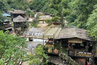
Cat Cat village
Where is Cat Cat village? Cat Cat village is a small village located in Muong Hoa valley in Lao Cai province; About 2km from Sapa town center. Cat Cat village has long attracted tourism enthusiasts because even though it is only a small village, this place is covered with the green of mountains and forests, terraced fields mixed with the rustic and simple features of the houses. Small is built from wood. Thereby, giving visitors a sense of simplicity in contrast to the hustle and bustle of the city. Directions to Cat Cat village. From Sapa town center, there are many different ways and means that you can experience to get to Cat Cat village: 1. Trekking For those who love enjoying natural landscapes and want to have a clearer view of the daily lives of local people, trekking is definitely a great choice for you! Trekking not only helps you improve your physical fitness, the authentic experience makes the trip more memorable, but it's also completely free. 2km is the distance from Sapa town to Cat Cat village, if you like it, you should try it once! If you love the beauty of Sapa and want to see more of the beautiful scenery here, you can see more about trekking at Ky Quan San - Sapa's paradise in the clouds and Bach Moc Luong Tu - one of the four highest mountains. our country. 2. Rent a motorbike For those who want to travel more conveniently, you can choose to rent a motorbike to cross the roads from Sapa to Cat Cat village. The road is not too difficult or rough and is short, so you don't need to worry too much. Just drive carefully and drive at a moderate speed. Motorbike rental prices in Sapa range from 100,000 - 240,000 VND/day. 3. Rent a bicycle In addition to trekking and renting motorbikes, we can also experience the bicycle rental service to go to Cat Cat village. Normally, hotels in the tourist town of Sapa will have this service available, you just need to ask the receptionist, rent a car and go. Bicycle rental prices in Sapa range from 120,000 - 150,000 VND/day. This is also a way to bring a new experience to your trip to Cat Cat village. If you have the opportunity, invite your friends to try cycling together! What time should you travel to Cat Cat village? Cat Cat village is located in the Northwest high mountains, so this place has cool air all year round, each season is beautiful in its own way with outstanding characteristics. Spring is adorned with peach and plum blossoms; summer of bright yellow mustard flowers; The autumn of the bright golden rice fields and finally the winter of white snow covering every scene like a movie scene. For those who have never seen snow, try coming to Sapa in December to see the cherry blossoms blooming amidst the white snow and immerse yourself in the highland festivals. What to do in Cat Cat village? Coming to Cat Cat village, there are many things worth experiencing. First of all, when coming to the village, people will buy tickets to enter the gate to visit. Tickets for adults are 90,000 VND/person and tickets for children are 50,000 VND/person. At the beginning of the tour, people will mainly move on foot and motorbikes will be limited in entering and leaving this place to avoid affecting visitors. One of the must-try experiences is renting ethnic costumes to transform into ethnic boys and girls in extremely special clothes adorned with hairpins. Next is to buy handicraft items made by the skillful hands of local people to bring back as gifts. Here, items such as earrings, bags, costumes,... look extremely unique and stand out thanks to the brocade patterns and motifs embroidered onto the products, bringing bold artistry and character. culture of highland ethnic people. Some notes when visiting Cat Cat village. Before going, choose clothes suitable for the weather to avoid cold or hot weather. Book hotel rooms in advance to ensure availability when traveling during peak season. Limit littering in public places to protect the environment, natural landscape and living space of local people. Plan in advance (like shooting angle, lighting,...) to have beautiful virtual photos Choose comfortable shoes, sneakers, etc. for convenient movement because the path in Cat Cat village will be uneven and sometimes slippery due to a nearby waterfall. Bring medication, sunscreen, sunglasses, and long-sleeved clothes to avoid the midday sun on the high mountains. Cat Cat village is one of the places you must definitely try when coming to Sapa to have the opportunity to see more clearly the lifestyle and culture of the H'mong ethnic people here along with the vast mountain and forest scenery. The terraced fields stretch out extremely peaceful and beautiful.
Lao Cai
10263 view
 AI Travelviet